The Tuolumne River is rafting Nirvana. This dam controlled summer run has fun Class IV and IV+ rapids and beautiful scenery. The "T", as it's lovingly called begins in Yosemite on the North Face of Mount Lyell and flows through Tuolumne Meadows and the Grand Canyon of the Tuolumne before being impounded by Hetch Hetchy Reservoir.
Featured Outfitter
 ARTA River Trips (209) 962-7873 has over 60 years of experience on the most iconic rivers of the west.
The Tuolumne can be done in one day but why? The camps on the Tuolumne are downright beautiful and the side hikes to water slides on the Clavey River and North Fork of the Tuolumne are well worth the effort.
Trip Highlights
Mile 0: Put-in at Meral's Pool. Part of the adventure is a 6 mile drive down a steep dirt road to reach put-in.
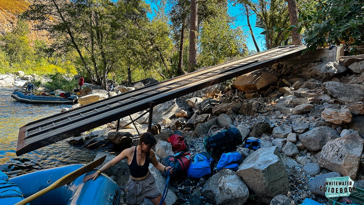
The new boat ramp at Meral's Pool on the Tuolumne River
Mile 0.1: Rock Garden (IV) is one of the most difficult rapids at low water because there are small channels and several places to wrap a boat.
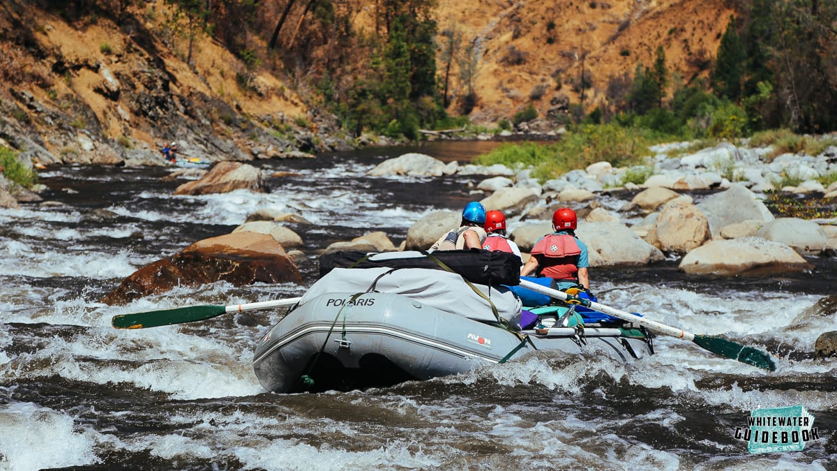
Just above Indecision Rock in Rock Garden Rapid on the Tuolumne River
Mile 0.4: Nemesis (IV) is particularly well named when the water is low. It comes soon after Rock Garden and is difficult to scout due to it's long lead entrance.
Mile 0.9: Sunderland's Chute (IV) has a tricky entrance at low water. At all levels there are some holes you want to try and avoid by going center or left after you enter.
Mile 1.1: Hackamack Hole (IV) is named in honor of Bob Hackamack and after a huge hole that appears at higher flows.
Mile 1.55: Ram's Head (IV) is one of the biggest rapids on the Tuolumne above 4000 cfs due to a huge hole. The entrance moves change with water levels but you want to finish right at all levels.
Mile 2: India (IV) is named to honor India Fleming who was the first woman to kayak the Tuolumne at 16 years old.
Mile 2.05: Phil's Folly (IV) comes soon after India and is one of the most difficult rapids on the Tuolumne above 7000 cfs.
Mile 3.3: Tin Can Cabin is a large campsite that has the foundation of an old cabin. There is a hiking trail from here to Lumsden Road.
Mile 4: Zach's Falls (III++) is a technical challenge through boulders and holes, depending on the flow. The low water left line is sometimes incorrectly referred to as "Zach's Crack."
Mile 4.35: Stern (IV) is a particularly tricky rapid at low flows. At lower levels, you can attempt to go left of the big rock or perform a fancy airplane turn to go right of it.
Mile 4.5: Aaron's Folly (II+) can wrap a boat if you try and split the boulders to show off.
Mile 4.8: Evangelist (IV) is holey, hence the name.
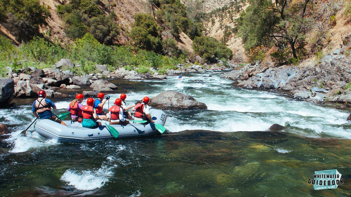
Heading into Evangelist at 1000 CFS
Mile 5.1: Bent Thole Pin (III+) has an undercut rock on the left side that famously destroys thole pins, oar locks, and frames in general. There is a right line at low water that takes rafts over a steep drop that can launch paddle boat guides. This rapid is also known as "Frame Crusher" or "Airborne."
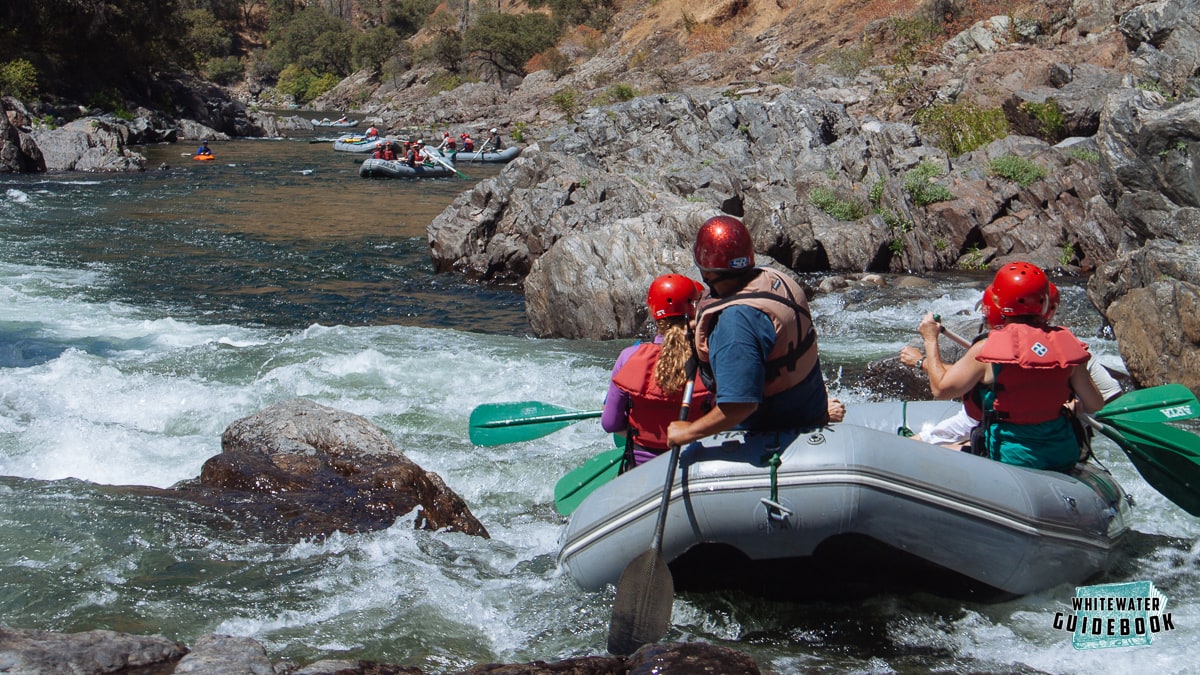
Paddle rafting the right side of Bent Thole Pin will make you go Airborne
Mile 5.45: The Clavey River enters on the right and there are great camps on the right and left side here.
Mile 5.5: Clavey Falls (IV+/V) is just downstream. This is the most difficult rapid on the run and is either Class IV or V depending on flows and who you're talking to.
Mile 5.8: Son of Clavey (III) is a fun rapid that comes soon after Clavey Falls.
Mile 6.9: Little Niagra (III+) is a tricky rapid famous for causing wraps. This is also known as Corner Pocket or Blacks.
Mile 7.7: The Powerhouse is a great place to camp on the right.
Mile 8.1: Grapevine Creek enters from the right. There used to be a campsite below here on the left but it's now underwater after a 2017 landslide move the river bed to the left.
Mile 8.5: Indian Creek enters from the left and Indian Creek Camp is a great camp immediately downstream from the creek on the right. There is a trail that leaves the river hear on river left.
Mile 9.2: Wheelbarrow Camp is on the left just above Grey's Grindstone.
Mile 9.75: Gray's Grindstone (IV) is a nearly mile long rapid that is the favorite of most river guides. The entrance is generally the most difficult part at all flows and can be scouted from the right or left.
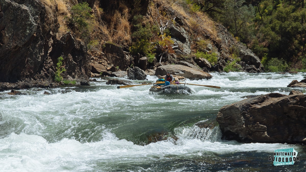
Rowing the Entrance of Grey's Grindstone Rapid on the Tuolumne River
Mile 10.9: Surf City (III+) has a fun surf spot at the top a lower flows.
Mile 11.7: Thread the Needle (II+ or IV) has a challenging narrow chute on the right that can wrap or flip a raft if you miss the move. There is usually also a log jammed in the chute. It's highly recommended to run the Class II+ "chicken shot" on the left.
Mile 11.75: Driftwood Camp is a large camp on the left bank with some sand.
Mile 11.85: Driftwood Rapid (III) is a fun rapid if you like dodging boulders.
Mile 12.5: Steamboat (III) has a fun surf hole at lower flows that can flip rafts.
Mile 12.8: Cabin (IV) is a fun, tricky rapid between boulders.
Mile 12.9: Big Creek enters on the left. There is a decent camp and adventurous hike up the creek here.
Mile 13.1: Hell's Kitchen (IV) is the last Class IV rapid and fairly challenging at all river levels. You may want to scout this one on the left side.
Mile 14.5: Mohican Camp is on the left. There is an old 4wd road that is now a hiking trail out of the canyon. There is an old mine here and a stamp mill hidden high above the camp near the top of the canyon.
Mile 15.3: The North Fork of the Tuolumne enters on the right. There are campsites before and after the North Fork of the Tuolumne on river right. If you have time, there's a great hike/scramble up to a swimming hole and natural waterslide at Devil's Gate.
Mile 16.5: Don Pedro reservoir starts here when it's full. When it's not full you'll enjoy Boilermaker (III) and Matterhorn (IV-) and a few more fun rapids.
Mile 17.7: Pinball (IV) is usually covered by the water of Don Pedro Reservoir, but in drought years this rapid comes alive. There are several routes and all of them involve slamming into rocks. Scouting is a good idea here.
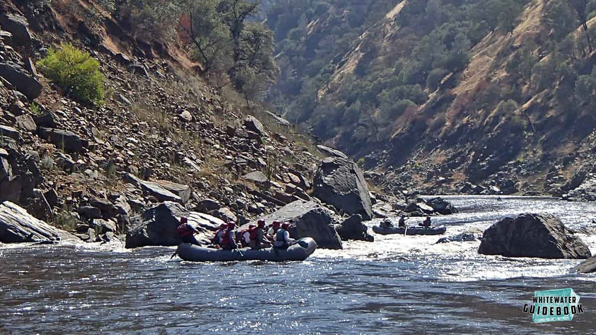
Pinball Rapid on the Tuolumne River - notice the high water line of Don Pedro Lake
Mile 18.2: Take-out at Ward's Ferry Bridge. It's also possible to get a tow across the reservoir and take-out at Moccasin Marina.

