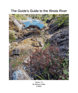
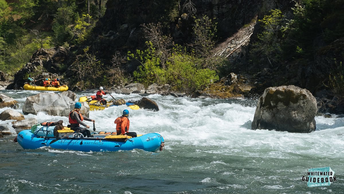
Mention the Illinois River to any experienced boater and their eyes will light up. It's legendary for big whitewater, beautiful camps, and jaw-dropping scenery. This trip flows through the northern end of the famously rugged Kalmiopsis Wilderness in Southern Oregon.
River flows on the Illinois are highly variable due to it's rocky watershed and the unpredictable weather of the Siskiyou Mountains. High flows are dangerous on the Illinois, so you'll want to avoid going during or after heavy rains. If you're lucky enough to have sunny weather you'll experience a deep green water color that is unlike any other.
Featured Outfitters
 ARTA River Trips (209) 962-7873 has over 60 years of experience on the most iconic rivers of the west.
 Momentum River Expeditions (541) 488-2525 offers world-class rafting and adventure travel trips in Oregon, Northern California, Idaho, Alaska, and beyond.
 Northwest Rafting Company (541) 450-9855 is an award-winning group of professional, well-trained guides that lead people down the most beautiful rivers in the world.
The unique serpentine geology of the region produces many unique (and endangered) plants. The most interesting is the Darlingtonia Californica (a.k.a. Pitcher Plant) which has adapted to the lack of nitrogen in the soil by trapping and digesting insects.
Trip Highlights
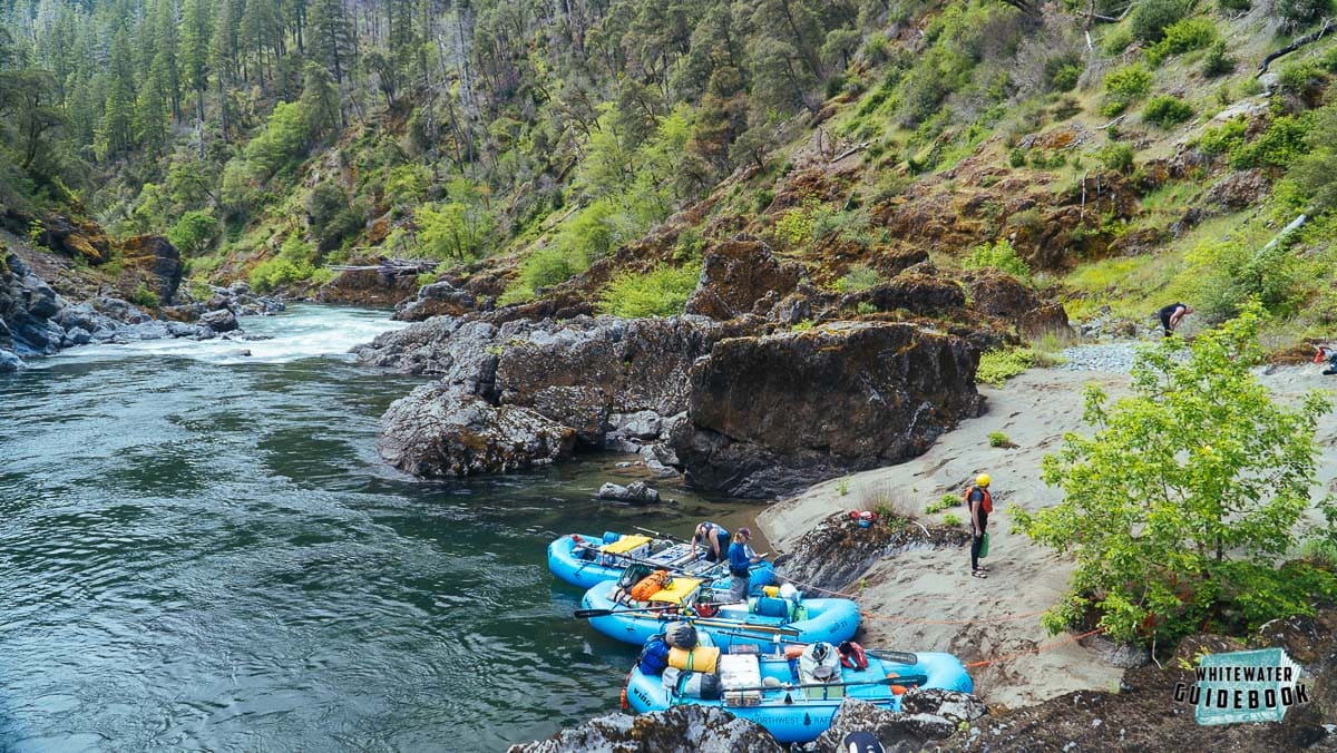
Mile 0: Put-in at Miami Bar Boating Site, an unpaved boat launch. There is an alternate put-in 4 miles upstream at McCaleb Ranch.
Mile 1.7: First Camp (right) is a great place to camp if you get a late start.
Mile 2.35: Briggs Creek Rapid (II) is just above Briggs Creek which enters from the right side.
Mile 2.7: Panther Creek enters on the right hand side and signals the beginning of the Panther Creek Rapids (III). This is a series of three rapids that make a good warm up for the bigger drops downstream.
Mile 3.2: Labrador Creek Rapid (III) begins immediatey after Labrador Creek enters from the left. The Kalmiopsis Wilderenss Boundary is just downstream.
Mile 3.45: Nome Creek Rapid (III) occurs just after the river bends to the right and Nome Creek enters from the left.
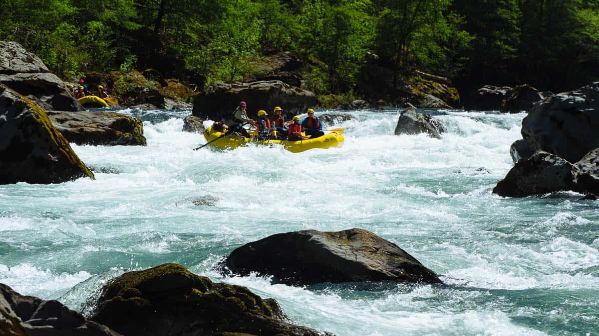
Mile 3.95: A large boulder rising above the horizon line marks Rocky Top (IV), the first Class IV rapid known for the dangerous undercut boulder in the middle of the rapid. At most flows there is a sneak line on the far right.
The right line at Rocky Top
Mile 4.25: Rock Garden North (III) has a shallow entrance with some tricky moves at low water.
Mile 4.6: York Creek Rapid (IV) is a fun, long rapid that begins soon after York Creek enters from the right.
Mile 5.2: The Goat (III+) has a rock slide on the right which drives the current into the left wall.
Mile 5.4: Clear Creek Rapid (IV) is a long rapid with some big holes at the bottom. Clear Creek cascades down the right wall after the rapid.
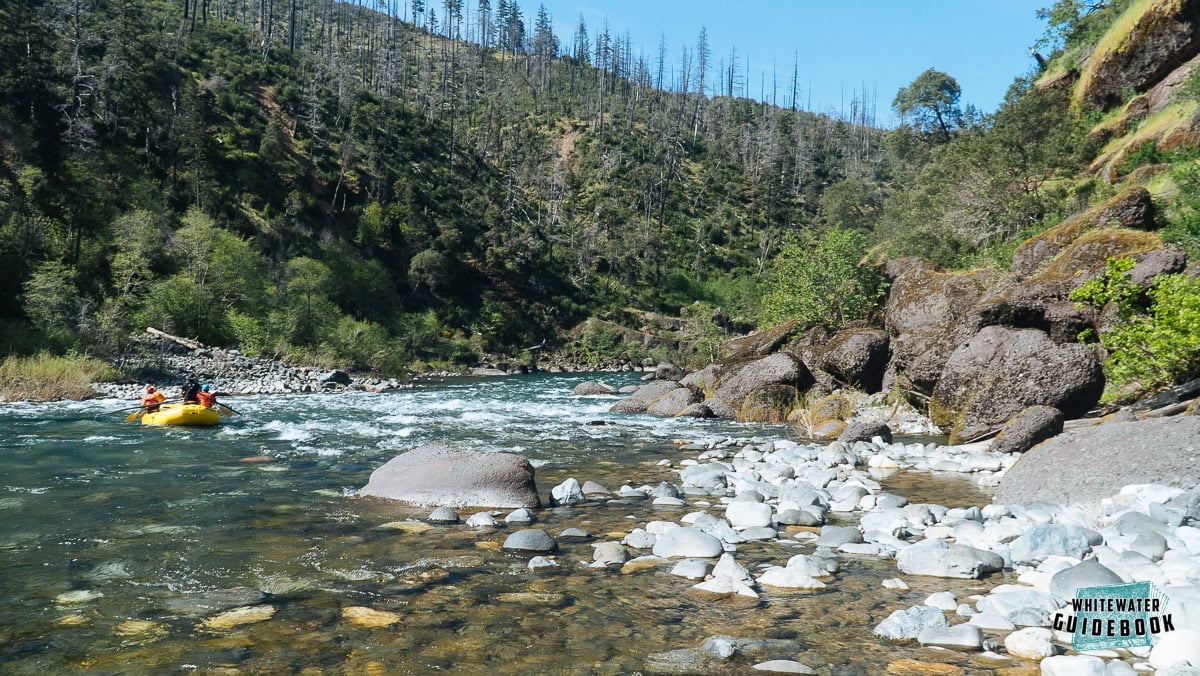
Mile 6.1: After a flatwater section, there is a small camp (or lunch spot) on a sandy beach on the right bank.
Mile 6.5: Rapid #29 (II) has a narrow channel on the right that is fun for rafts and kayaks. There is a great kayak surf wave in the main channel with good eddy access.
Taking the right line at Rapid #29
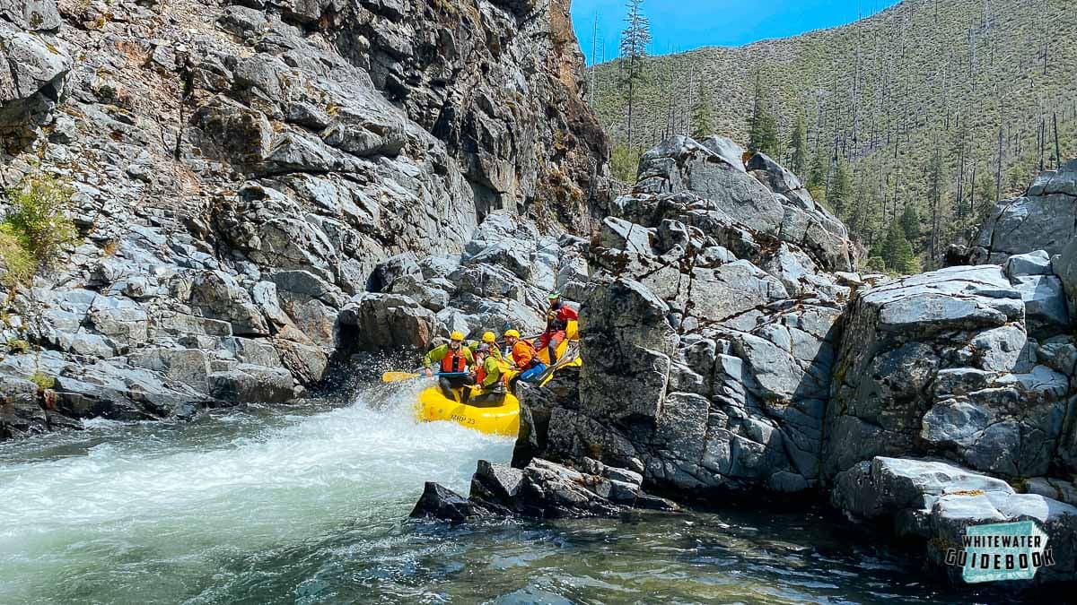
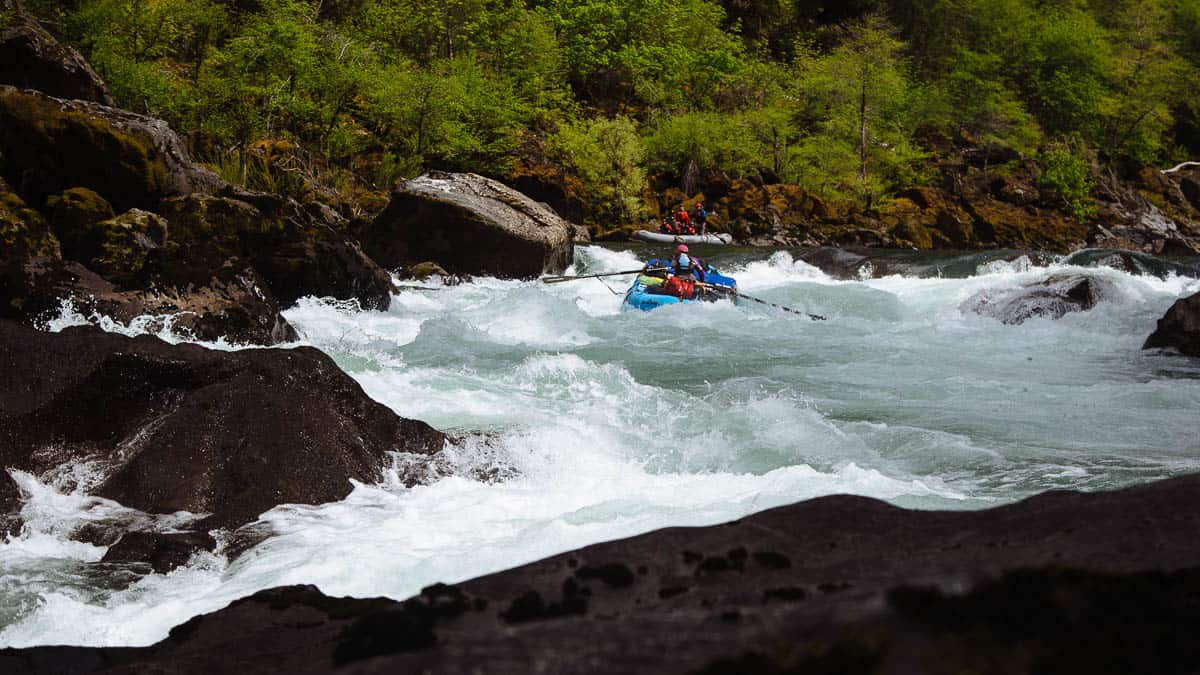
Mile 7.8: Pine Creek Rapid (IV+) is separated into two channels by a large rock island. The left side is an easy Class II move and the right side and Class IV move around (or possibly through) a big hole known as the "Boat Eater."
Paddle raft hitting the Boat Eater at low water
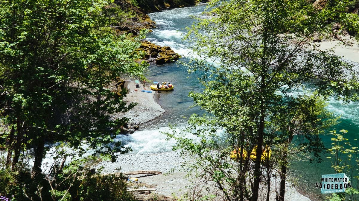
Mile 8.0: The area just downstream of Pine Creek Rapid is known as Pine Creek Flat. There are large camps on both sides of the river here.
Mile 8.9: Wallbanger (aka Florence Creek Rapid) (III) occurs where a rock bar extends into the river from the right and forces the main current left into a wall on the left.
Mile 9.8: Klondike Creek enters from the left side.
Mile 11.6: Time Warp (IV) comes up quick after a mellow sectoin. This drop begins slow and quickly speeds up into the main drop which has several rocks on the right and a decent sized hole on the left. There is a fairly easy and fun scout on the right bank.
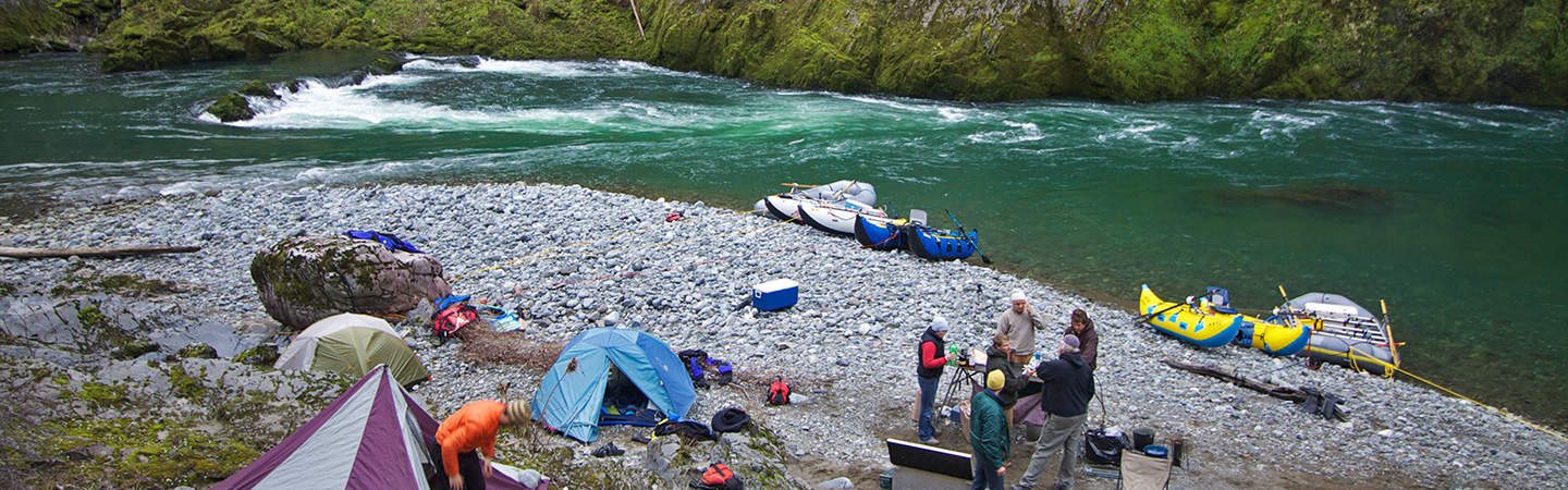
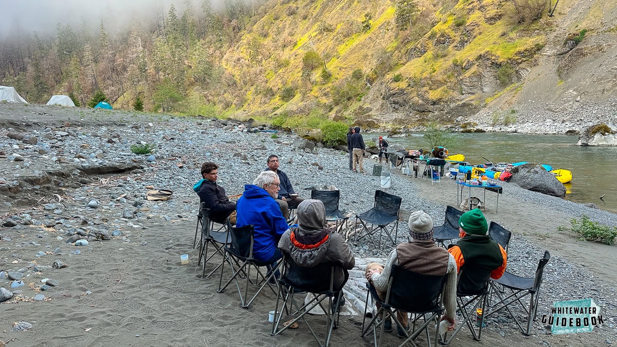
Mile 12.7: Deadman's Bar has a big camp on a bar high above the river on the right side. Look for a small eddy on the right with a rocky trail up to this bar about 30 feet above the river. It's a bit of work to get your gear up to the camp but this is one of the few camps in this part of the river.
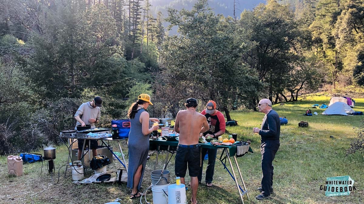
Making dinner at Deadman's Bar on the Illinois River
Mile 13.3: Rapid #63 (III) occurs where the river bends to the the left between rock walls. Tony's Camp is a medium sized camp just downstream on the right.
Tony's Camp on the Illinois River
Mile 15.4: Rapid #78 (III) is one of the many great Class II and III rapids in this section of the river.
Mile 16.8: South Bend is a small camp or a nice place to regroup and have lunch before Green Wall. You'll recognize it by a big Radiolarian chert (pinkish/reddish rock) boulder on the right and a small creek entering on the left.
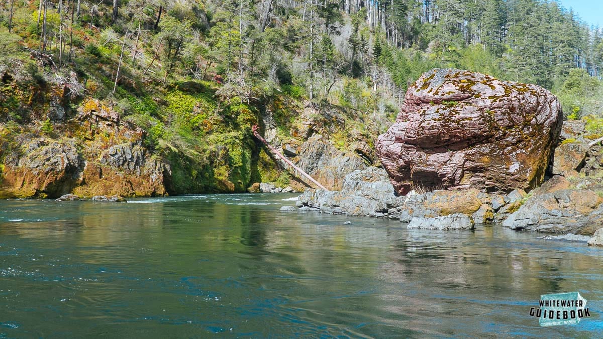
A Radiolarian chert boulder on the right marks South Bend
Mile 17.4: Prelude Rapid (IV), aka Fawn Falls, marks the beginning of the most difficult section of the Illinois River. There is a nice far left chute at lower flows. At medium and high flows there is a nice right line that is pretty straightforward.
Mile 17.8: Green Wall (V) is a famous rapid that should be scouted from the left. It's a long, complicated rapid that can be portaged by kayakers with some effort. It would be VERY difficult to line or portage rafts.
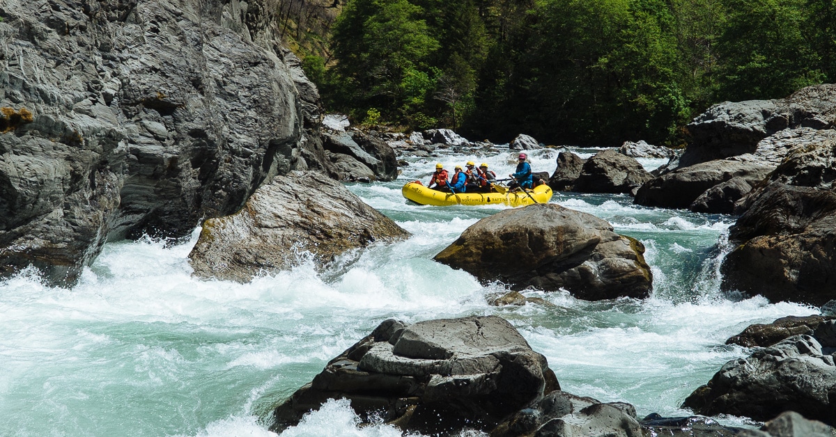
Green Wall Rapid on the Illinois.
Mile 18.5: Little Green Wall (IV) is a tricky rapid that is tough to scout and can cause more problems than Green Wall. The next 2 miles has nearly continuous Class III rapids.
Mile 19: Rapid #98 (III+) has two large boulders in the middle of the river that provide three distinct lines.
Mile 19.3: Sweeney Todd (III+) is fairly easy at regular flows and one of the hardest rapids for rafts at low water.
Mile 19.8: Rapid #103 (III+) is formed by large boulders that seem to block the entire river.
Mile 20: Holey Pohle (IV) has a ton of boulders in the entrance that offer a variety of ways to enter. This is one that you may want to consider scouting from the right side.
Holey Pohle Rapid on the Illinois River
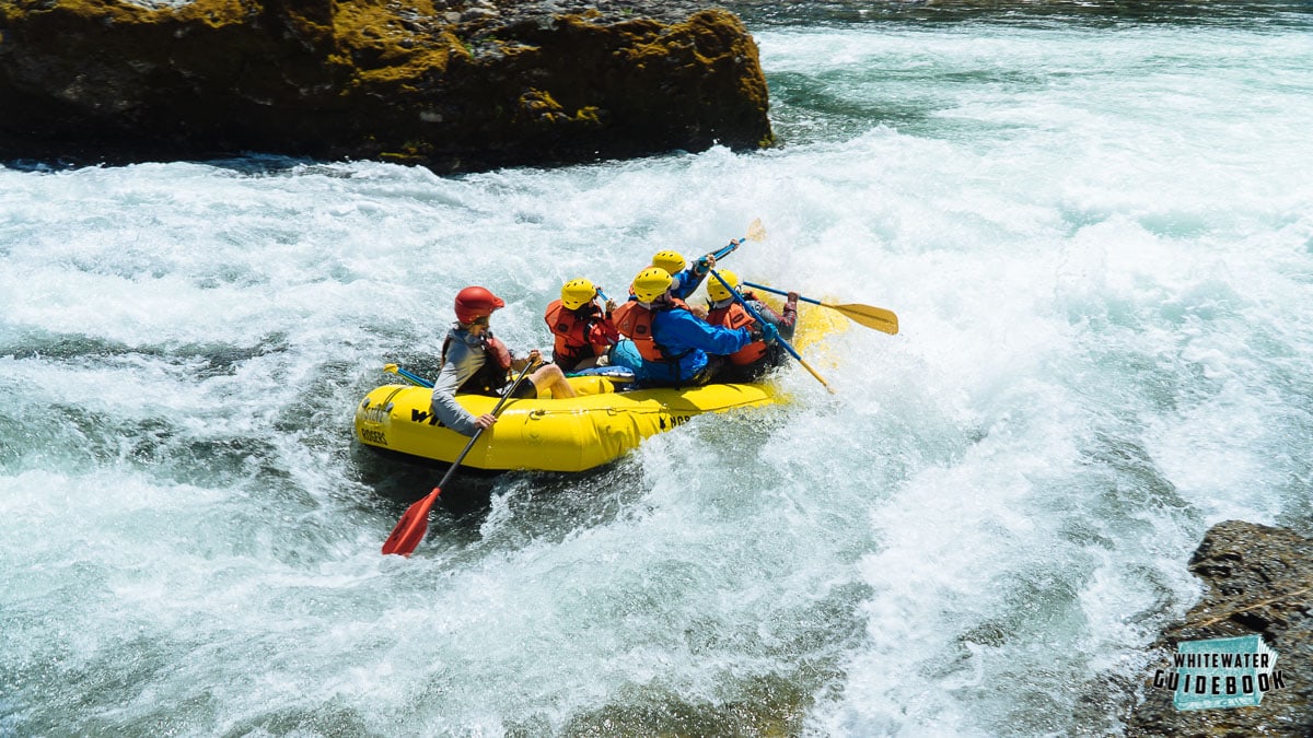
Mile 20.5: Submarine Hole (IV+) has a reputation for flipping rafts at all flows for a variety of reasons. At lower flows rafts flip by riding up the right bank. At higher flows rafts can flip in one of its huge holes.
Negotiating Submarine Hole Rapid on the Illinois River at 1,000 cfs
Mile 21.3: Collier Creek enters from the left and there is a camp just downstream on the left. This creek is named after early pioneer and miner Cole Collier.
Mile 24.5: Conglomerate Rapid (II) has geology reminiscent of Flora Dell on the Rogue River
Conglomerate Rapid on the Illinois River
Mile 24.9: Silver Creek enters on the right side. This beautiful creek is worth exploring if you have some time since the There is access to the Illinois River Trail here and a nice side hike to Conner's Place.
The mouth of Silver Creek is a great place to have lunch or hike along the Illinois River Trail
Mile 25.6: Rapid #131 (III+) is a fun rapid with a medium sized campsite on the left at the bottom.
Mile 27.8: Indigo Creek enters from the right side. The left bank is a good place to see Darlingtonia (Pitcher Plants) and other rare plants.
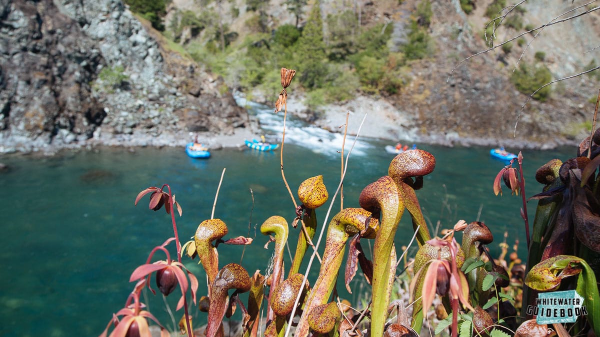
Daringtonia (Pitcher Plant) with Indigo Creek in the background
Mile 28.4: Rapid #143 (III) has a fun wave train that goes by a rock on the right you'll want to avoid.
Mile 28.47: The Illinois River flows through a beautiful canyon. Buzzard's Roost is a small peak 1500 feet above the river on the right. This was the site of the proposed Buzzard's Roost Dam.
Mile 28.9: Horsesign Creek enters on the left after Horsesign Creek Rapid (III+).
Mile 29.7: Lynch Bar is a big sandy beach on the right that makes a wonderful camp. It's common to camp here for the last night in order to take out in the morning before a long drive home.
Camping at Lynch Bar on the Illinois River
Mile 30.4: Nancy Creek enters from the left.
Mile 30.7: Lawson Creek enters from the right.
Mile 31.2: Take-out on the right bank at Oak Flat. You can also continue down a few miles and take-out on the Rogue River.