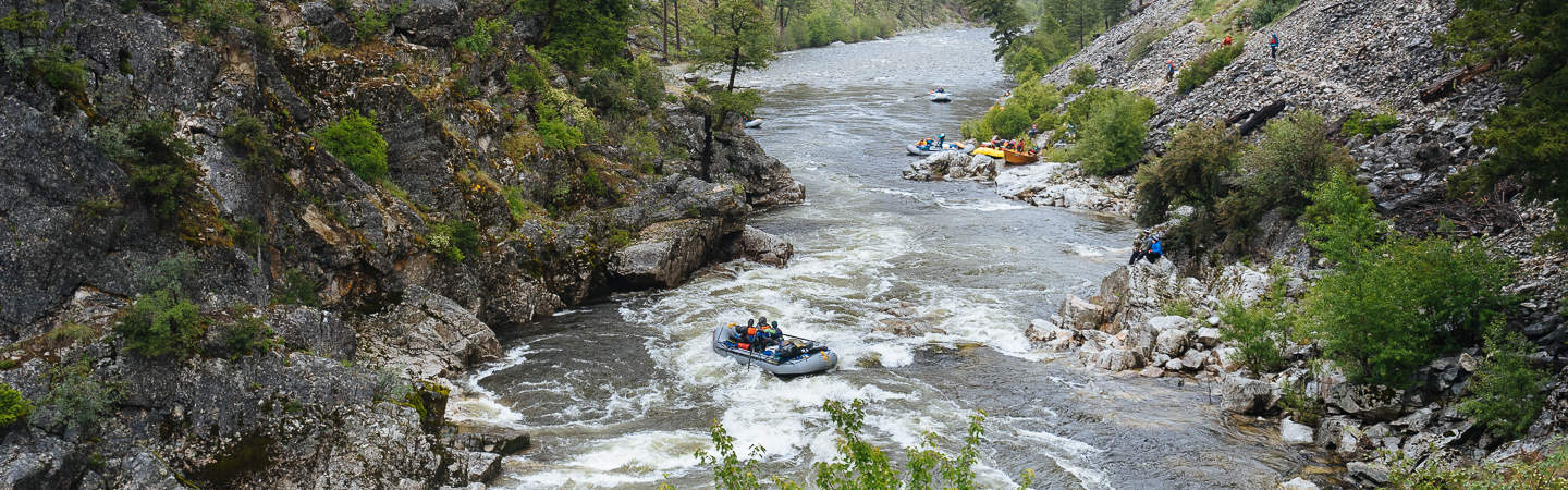
The Middle Fork of the Salmon (aka "The Middle Fork") is perhaps the best river trip in the world. This "bucket list" trip runs for 100 miles of nearly continuous rapids along with world class trout fishing, hot springs, wildlife, and amazing scenery. Permits are required and issued by the Forest Service through a competitive lottery that occurs each January. Won a permit and want a guide to planning your trip? Check out our Middle Fork Trip Planning Blog.
Featured Outfitter
 Northwest Rafting Company (541) 450-9855 is an award-winning group of professional, well-trained guides that lead people down the most beautiful rivers in the world.
The Middle Fork flows through the heart of the Frank Church - River of No Return Wilderness in Idaho. The "Frank" is the second largest protected wilderness in the lower 48 states and famous for it's stunning mountains, wildlife, and for the Salmon River. This is a true wilderness trip!
Featured Shuttle Service
 Salmon River Transportation Company offers a variety of regular vehicle shuttle routes for the Middle Fork and Main Salmon at competitive prices. We will transport your vehicle from your starting point to your ending point while you enjoy your river trip.
Most trips start at Boundary Creek, a beautiful 90 minute drive from Stanley, Idaho. When the water drops in late July some groups choose to start their trip into the Indian Creek Ranger Station to avoid the first 25 mile which are quite difficult and hard one equipment at low water.
Trip Highlights
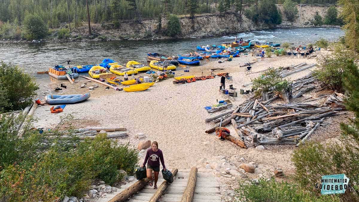
Mile 0: Put-in at Boundary Creek. Most people arrive the night before to rig their boats and slide them down the boat ramp.
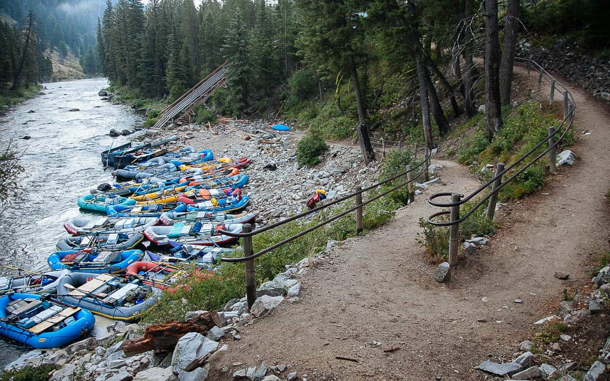
Boundary Creek Boat Launch
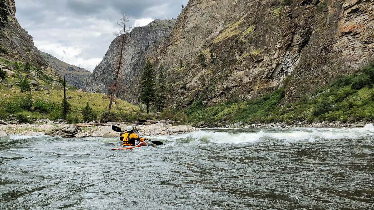
Mile 0.9: Murph's Hole is hardly noticeable at normal flows but can flip rafts above 4 feet. As the river gets higher this rapid becomes more difficult. It can be scouted by hiking down from Boundary Creek the night before you launch.
Murph's Hole at 6.5 feet
Mile 3.2: Sulphur Slide (III) had a massive landslide on August 3, 2023 that blocked the river.
Mile 4: Ramhorn Rapid (III) was changed by a landslide down Ramshorn Creek in 2022. The new rapid is easier than the previous one but will continue to change in the coming years.
Mile 4.7: Hell's Half Mile is a long (hence the name) rapid that is particularly difficult at low water. There was a landslide in August 2023 from a right side creek that dramatically changed the entrance and added new wood in the rapid.
Mile 5.3: Velvet Falls (III) is a classic rapid was blocked by a landslide down Velvet Creek on the evening of August 3, 2023. The new rapid is dramatically different and will continue to change over the coming years.
Mile 7.9: The Chutes (III) comes up soon after Trail Flat and immediately after the river bends to the left. It is another notoriously difficult rapid at low water.
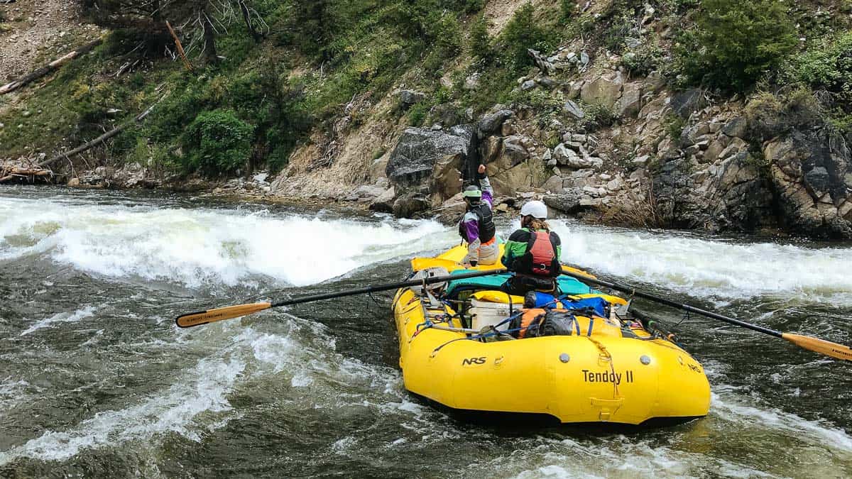
Mile 11.5: Powerhouse Rapids (III+) are made up of 3 distinct back to back rapids.
Mile 18.5: Rapid River enters from the right side.
Mile 21.7: Lake Creek Rapid was formed by when Lake Creek blew out on July 26, 2006 sending logs downstream to Pistol Creek which spanned the river and were eventually blown out by dynamite.
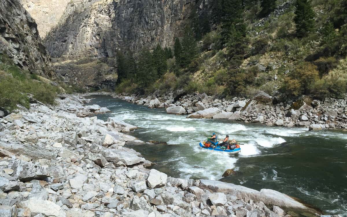
Mile 22.1: Pistol Creek Rapid is a classic s-turn rapid between vertical walls. You can scout on the right by catching the large Eddy above Lake Creek or a smaller eddy just below Lake Creek Rapid.
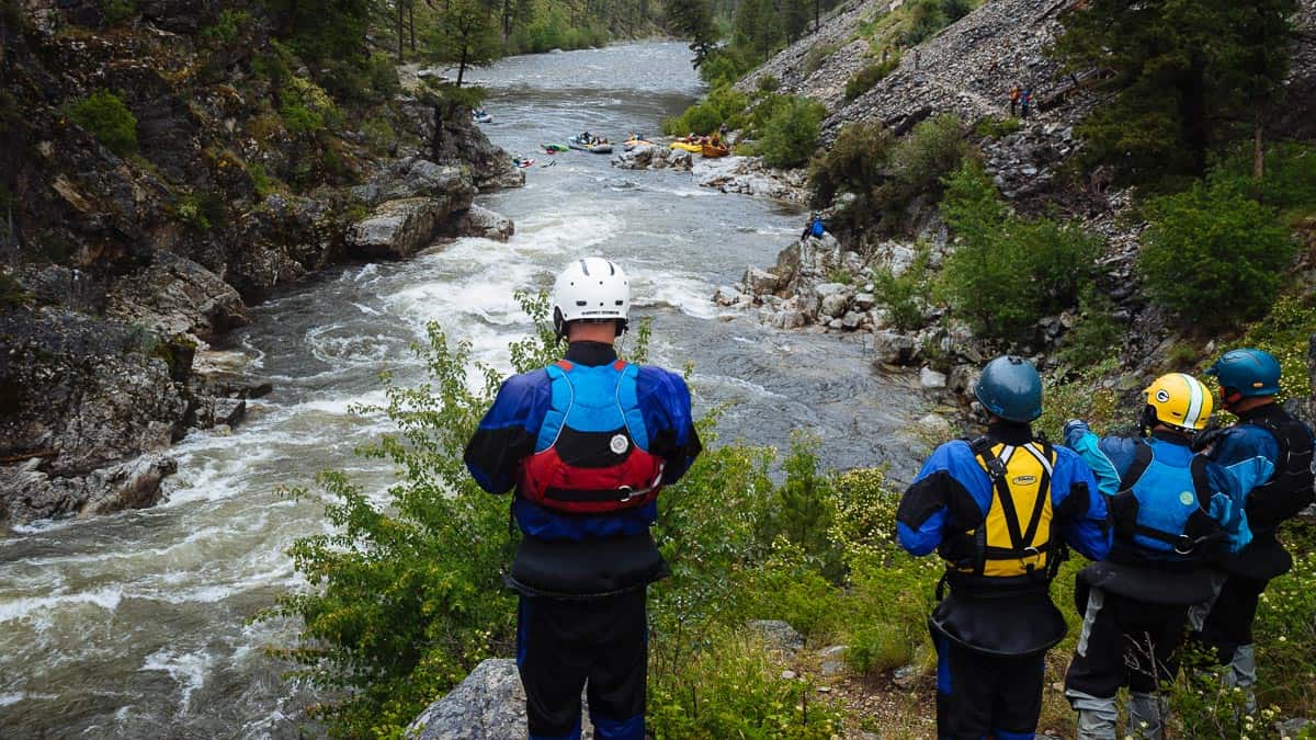
Scouting Pistol Creek Rapid on the Middle Fork of the Salmon River
Mile 25.5: Indian Creek Airstrip is an alternate put-in that is commonly used at really high (> 6') and lower water (< 2.2'). You can fly all or part of your equipment into this airstrip. The Forest Service has a camp here and is set up to issue permits.
The Indian Creek Boat Ramp and Launch on the Middle Fork
Mile 32.5: Marble Creek Rapid (III-) is at a right hand turn in the river. It has a large wave on the left and a sticky hole on the right at most flows.
Surfing the Marble Rapid wave at 3.5 feet
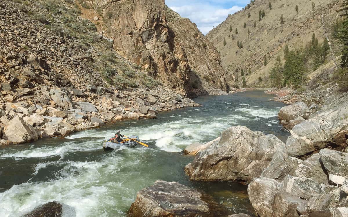
Mile 33: Ski Jump Rapid (II or IV) is pretty straightforward at lower river levels. At higher flows it can be one of the most difficult and dangerous rapids on the river. The best way to scout at high water is to walk down from Marble Left camp.
Mile 33.6: Sunflower Hot Springs is a popular stop on the right.
Mile 38: Jackass Rapid (II-) can be a bit trick at lower flows.
Mile 50: Loon Creek enters on the right hand side. Most groups camp near Loon Creek as there is a great hot spring about a mile up the creek.
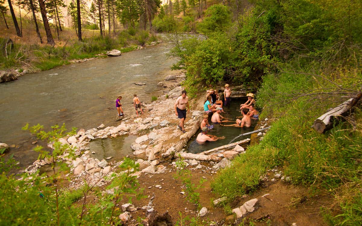
Loon Creek Hot Springs
Mile 57: Grouse Creek Rapid (II+) is a fun S-turn rapid and a good warm up for the Tappan Rapids downstream.
Mile 58.2: Tappan I (III-) is the first of the Tappan series of rapids.
Mile 58.5: Tappan Falls (III+) is the biggest rapid of the Tappan series of rapids. At higher flows it can be scouted on the left and at lower flows it can be scouted by smaller boats from the right.
Mile 59: Cove Creek Rapid (or Tappan 2 1/2) changed Tappan III and part of Tappan II after the Cove Creek landslide in 2008. Since this rapid was formed by a recent landslide it changes each season.
Mile 60.3: Camas Creek is a major tributary that enters form the right.
Mile 66.6: The Flying B Ranch is a privately owned ranch with an airstrip just downstream. This is a popular stop for rafters as they have a store that sells ice cream, beer, and other goodies.
Mile 67.8: Haystack and Bernard Rapid come in quick succession soon after the Flying B Ranch.
Mile 78: Big Creek enters from the left marking the beginning of the Impassable Canyon. There is no trail along the river downstream of Big Creek as cliff walls commonly rise from the river.
Mile 80.3: Veil Falls is a popular stop. Eddy out on the right and hike up through boulders to a beautiful cave and waterfall.
Mile 80.6: Porcupine Rapid aka Wall Creek Rapid (III-) is a series of wave trains with some holes at the entrance. It begins at the end of a pool as the river bends to the right.
Porcupine Rapid is also known as Wall Creek Rapid
Mile 82.2: Redside Rapid (III) comes right after the river takes a sharp turn to the right.
Mile 82.6: Weber Rapid (III) is a fun series of hydraulics that comes up quick following Redside. At high water this rapid is known as "Corkscrew."
Weber Rapid at 3 Feet
Mile 88.3: Cliffside Rapid (III) follows a long calm stretch. It's fairly easy at higher flows and at lower flows forces you against the cliff wall on the right. Lower Cliffside Rapid (III) follows soon after.
Lower Cliffside Rapid at Low Water
Mile 91.1: Rubber (III+/IV) is typically one of the bigger rapids in the Impassable Canyon. At lower flows it's pretty straightforward, but at higher flows it has some large hydraulics that commonly flips boats.
Rubber Rapid at 3 Feet
Mile 93.2: Devil's Tooth (III+) is a fun rapid full of rocks that create holes and big water and a technical line at low water. It can be scouted on the left.
Mile 93.2: House of Rocks (III+) has several lines and the most conservative line is the far left. There is a main center channel that timid boaters may want to avoid due to the dangerous sieve on the right.
Mile 99.5: Cramer Creek Rapid (IV) was formed when Cramer Creek flash flooded in 2003. Due to the combined flows of the Middle Fork and Main Salmon, this is a Grand Canyon style of rapid with big waves and hydraulics. It can be easily scouted from the right bank.
Mile 100: Take-out at Cache Bar. This can be a very congested take-out so please be respectful of others. If you want to have a relaxed take-out, arrive after 2 PM.