The Lower Salmon River, often dubbed the "Lower Salmon Canyons," is a gem for adventure lovers, boasting warm waters, vast sandy beaches, and rugged desert canyons that define its path through Idaho. Stretching 112 miles from Vinegar Creek—where the Main Salmon ends—to the Snake River, but most rafters set their sights on the 72-mile section from Hammer Creek to Heller Bar. Its lower elevation brings a drier climate, scorching sun, and some of the largest inland beaches around, making it a top pick for multi-day rafting trips.
This undammed river flows through four distinct canyons—Green, Cougar, Snow Hole, and Blue—each adding unique scenery and excitement to the journey. Carved over millions of years, these steep-walled gorges create a striking landscape, blending thrilling rapids with calm stretches and massive beaches perfect for camping. The Lower Salmon’s mix of rugged beauty, warm swims, and desert solitude promises an unforgettable escape.
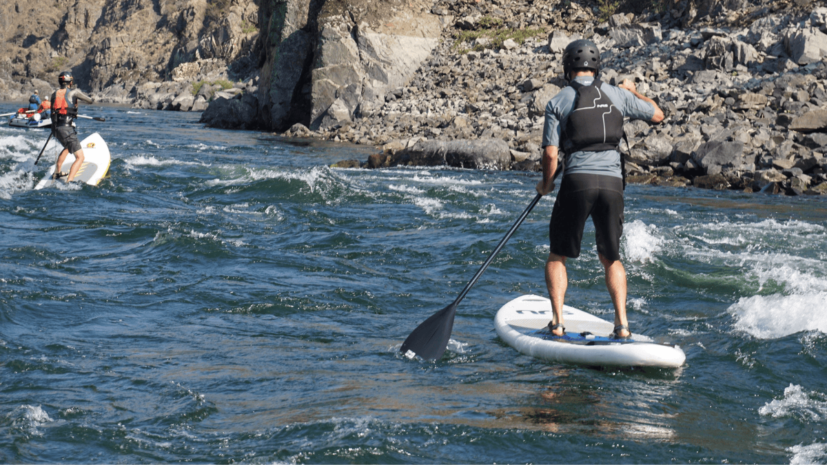
Deep, warm water makes this a great paddleboard run! Photo: Justin Smith - Adventure Idaho
Summer Crowds
Expect a spike in visitors during July and August on the Lower Salmon River, when groups flock to its warm water and amazing campsites, creating a sometimes crowded scene. Peak-season crowds can spark campsite tensions, especially for large groups of 20–30 people who need the super-sized spots, while smaller parties should opt for more modest sites to keep the biggest ones available.
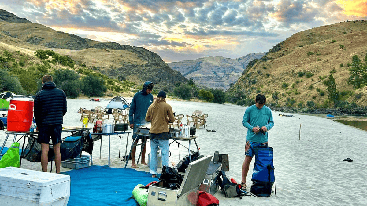
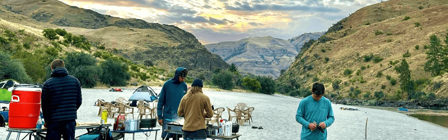
Beach Camping
The Lower Salmon’s beaches are enormous and abundant, but communication is key: chat with other boaters about your plans, be considerate if a site’s already taken or set aside for a bigger group, and don’t overlook the many small beaches that are much larger than they appear from the water. Always leave your campsite pristine—pack out all trash and human waste, use a fire pan, and follow BLM guidelines to preserve this extraordinary canyon for everyone.
Permits and Flows
A self-issued permit is required for overnight trips below Hammer Creek, and it’s easy to pick one up. The main season typically runs July through September, with flows driven by snowmelt. Recommended flows range from around 3,000 to 20,000 cfs at the White Bird gauge; the river never drops so low that it becomes unrunnable.
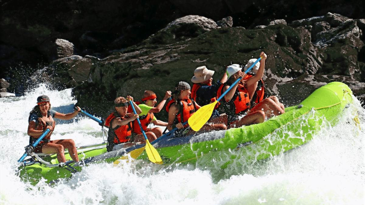
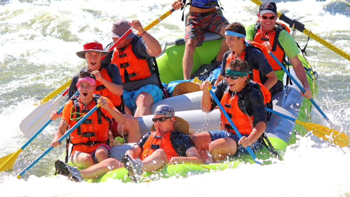
The Lower Salmon River is generally Class III to IV(-), with calm pools between bigger drops and dozens of fun, deep rapids scattered along its length—below, here's some standouts from Hammer Creek to the Salmon-Snake confluence, where mileages count down to the confluence.
Mile 43.7: Demon’s Drop (III–IV). A lively set of waves and holes that’s easy to miss if you’re not paying attention.
Mile 29.5: Lorna Lulu Rapid (II). Rated Class II but notorious for the wall on the right that’s tripped up unwary boaters.
Mile 28.1: Lower Bunghole (III). A punchy rapid with playful waves.
Mile 26: Bodacious Bounce (III). A rollicking stretch of fun waves.
Mile 25.5: Half and Half (III). A fun wave train with emerging holes and rocks as flows drop.
Mile 23.5: Snow Hole Rapid (III–IV). Often scouted for its powerful hydraulics and tricky boulders.
Mile 19: China Rapid (III–IV). A long rapid with large holes; the common line hugs the left shore to avoid trouble.
Mile 3.5: Slide Rapid (II–V). Highly flow-dependent. At high flows, it's a powerful Class V. Below 15,000 cfs, it mellows to a Class III, flattening further under 10,000 cfs.
Mile 0.7: Eye of the Needle (III). A short, turbulent drop with a few boulders in the current.
Mile 0: Salmon-Snake Confluence. At River Mile 0 (Snake River Mile 188.2), the Lower Salmon ends, merging into the Snake’s broader flow.
Put-In and Take-Out
Mile 0: Hammer Creek Recreation Site. Near White Bird, Idaho. Paved ramp, camping, and straightforward river access.
Mile 11: Pine Bar. A lesser-used access point with a boat ramp, located 11 miles downstream from Hammer Creek.
Mile 72: Heller Bar. Located 72 miles from Hammer Creek, including 20 miles of mostly flat Snake River water with Class I–II riffles. Headwinds are common. If parking at Heller Bar, note that Washington requires a Discover Pass.
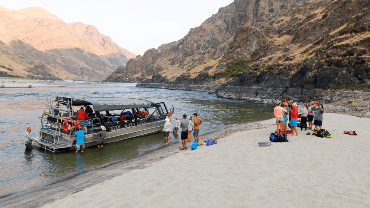
Mile 52: Pittsburg Landing. Located 27 miles upstream from the confluence on the Snake, this take-out reduces the trip to 52 miles from Hammer Creek. Arranging a jetboat to shuttle your group upriver from the confluence can be cost-effective for large parties. By midsummer, low Salmon River flows limit big jetboats, but running up the Snake to Pittsburg Landing remains viable. This option requires self-shuttling your vehicles over the 50-minute drive from Hammer Creek before launching.
Conclusion
With its warm water, giant beaches, and fun, pool-drop whitewater, the Lower Salmon River is a summertime classic. Just be ready for busy weekends, snag a self-issued permit, and keep things courteous on the water and at camp. Embrace the heat, enjoy the striking canyon vistas, and relish one of the best multi-day float experiences Idaho has to offer.

