North Fork Crooked Trip Report
Written By Yann Crist-Evans
Class: II, III, IV (P)
Length: 17.8 miles
Flow: 500-2500 cfs
Character: forested, canyon
Gradient: avg 38 fpm
Season: spring snowmelt (extremely short season)
Hazards: logs, waterfalls (2), wilderness isolation, continuous at higher flows.
Take-out: To reach the take-out, from Prineville: use OR 380 (S. Paulina Hwy) past the Prineville Reservoir following the main crooked upstream. take 380 just past Teeters road, where a bridge
crosses the NF right above its confluence with the main. This land is private above and below the
bridge so make sure you park in an established public domain. An alternate take out May be
possible where a jeep track (Teeters road) meets the NF Crooked near Teeters Ranch. However
this only eliminates a few river miles which are very entertaining.
Put-in: Take Ochoco Hwy to OR 42 and Put-in at Deep Creek Campground or if not yet open, go
about 200 yards past the entrance gate to a small easy access on the right, just as Deep Creek
meets the road. Access to put-in may be difficult until snow on the road melts.
Class II for the first 4 miles. At mile 1.6 a river-wide log blocks the left channel and again
at mile 3.2, take the right at higher flows. Here the gradient begins to pick up and some small
Class III emerges. Around mile 4.5 is Rip City (Class III) a great splashy series of beautiful surf
waves stacked for 60 yards around a left to right s-turn. Note that only half a mile below is the first
falls, so a swim above could make a boat recovery difficult.
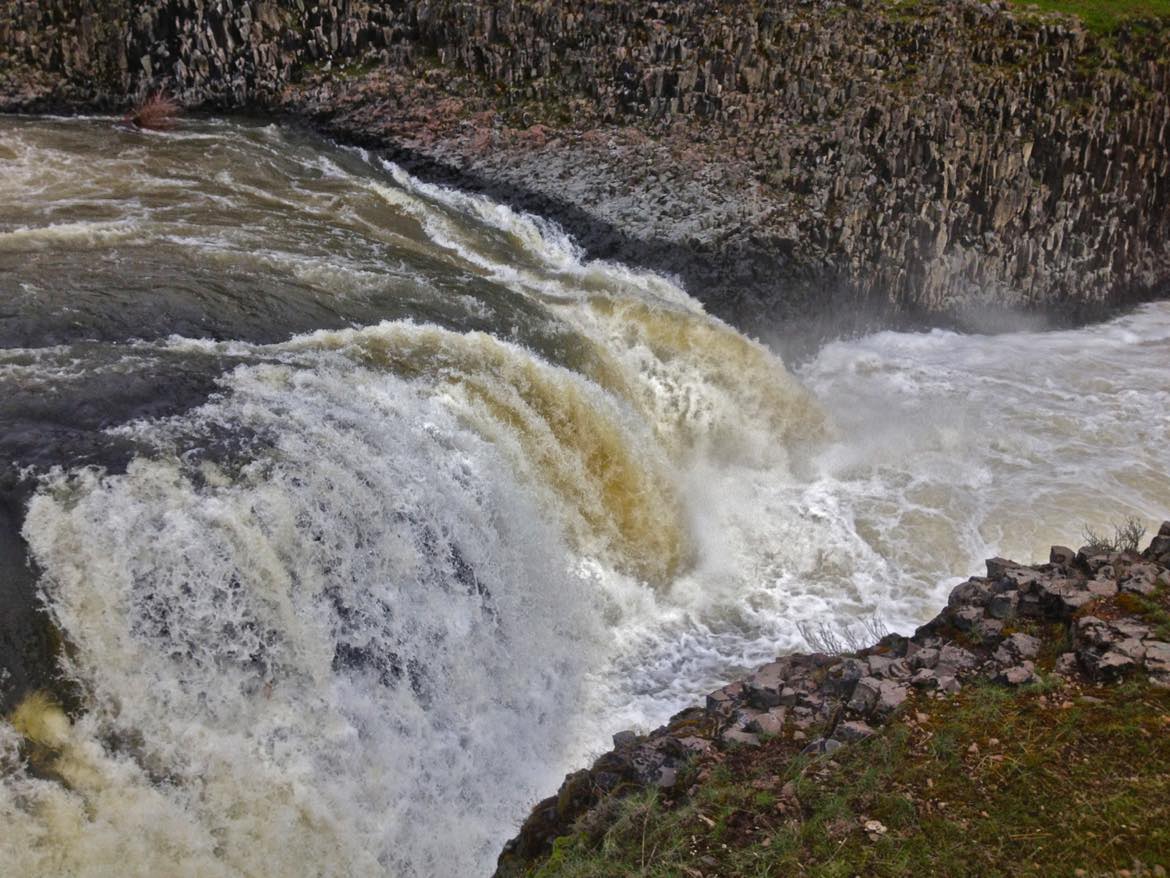
At mile 5.1 is the entrance drop of Upper Falls, a 17 footer with a boof line on the left
side. The first portage is possible on the right. Check the right side chute for logs, if clear, a raft
can be lined through down to the lowest eddy above the falls on the right. If you choose, follow
the cliff to scout the class IV- below.

Upper Falls on the North Fork of the Crooked River
There is a small steep slot past the green flats that allows for fairly easy access down to
the river below the falls. Make sure to look back up from the bottom, as it is a sight to behold.
However, be on your toes because the fun starts right around the bend.
The hits come up fast as you rejoin the current and in number at Show Some Guts (IV-).
A series of 4 ledge drops span the river for 200 yards. Below on the left is a nice recovery pool/
eddy.
After this, the river mellows out and enters Head Wall Gorge, where for the next 1.5 miles
the river takes on an arid characteristic. Jutting upwards on both sides of the river are columnar
Basalt tufts reaching to the sky like castle spires. Amaze Me (class II+) goes on for most of this
tighter gorge.
A little over a mile down is The Leaning Tree, a huge fallen tree over the river 40 ft above.
Around mile 8 is an amazing amphitheater camp on the left in heavy woods. This marks Mile 8.2.
At mile 8.6 you reach a chokestone in the river called the Troll Toll, a Basalt island splitting the
flow. Take the right side as it allows for easier passage.
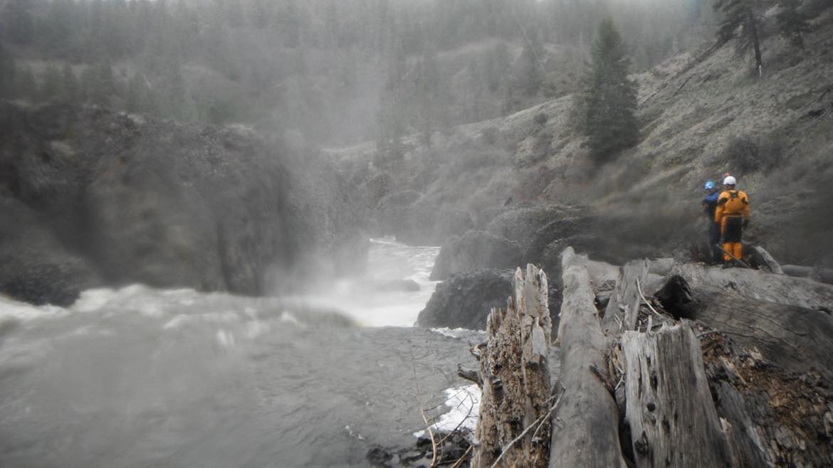
Pay close attention because at mile 10.1 a left turning gooseneck in the river brings you to Lower
Falls, a 30 ft vertical drop with a generous boof, flake right in the center. However the falls has
been run left of center, at the seam. At lower flows it is apparent that both sides of this waterfall
cascade into caves. Beware as this drop has only been done by few. Two known descents of
these falls were done by Scotty Baker and Kris Belozer. Scouting or portaging along river right is
the best option. There is a steep point of entry that drops gradually to the rivers edge and an
eddy.

Lower Falls on the North Fork of the Crooked River
Through a few twists and turns, a final one to the right brings you to a river wide log jam on the
surface of the water. The current is moving slow, so a boof in a kayak is possible near the middle.
A raft can be lined over on the left, so be sure to catch the final eddy before the log.
For a little over a mile the river meanders and regains the upper feel of class II and wooded pine
forests. At mile 11.8 a log blocks the right passage but allows enough room to pass on the left.
This log marks the beginning of the Crooked Mile (class III+). This gets broken down into two
sections, upper and lower Half Mile. The Upper takes a left turn through a really splashy boulder
garden into a wave train. A small recovery pool divide the upper and lower Half Mile but merge
together at higher flows. Lower Half Mile drops into a steep gradient and takes a sharp left turn
with a car sized boulder chocking the flow at the bend. It can be run either left or right above 1000
cfs but becomes a tight boulder garden with the majority of the flow pushing to the right below
1000.
Below is a section of class III called the Boondoggle that continues on through farm land for 2
miles.
The take-out is on the right or left below the bridge on private land so landowner permission is
recommended.


