The Deschutes River headwaters arise from Little Lava Lake near the base of Mount Bachelor in the Cascade Mountains of Oregon. It’s pristinely filtered waters funnel in and out of basalt caverns, lava tubes and channels above and below the surface of the Central Oregon high desert before making their way north, to the Columbia River. Although now impeded by many dams, the Deschutes River is historically one of the most stable watersheds in the world. Because the Deschutes River profile is largely comprised of lava rock, it’s riverbed, rock gardens and tight chutes can be sharp, unforgiving and provide a character unique to this region.
The Lower Deschutes or “Lower D” section between Warm Springs and Harpham Flats is perhaps the most popular overnight section and tends to be less constricted by lava rock than it’s parts further upstream. In this section, lava rock creates 2- 3 story bedrock cliff jumping opportunities as well as non-stop, amphitheater-style rim-rock composed of stacked terrace flood basalts and organ pipe formations. These epic skylines traverse various portions of this section and range from 900 to 2,600 feet.
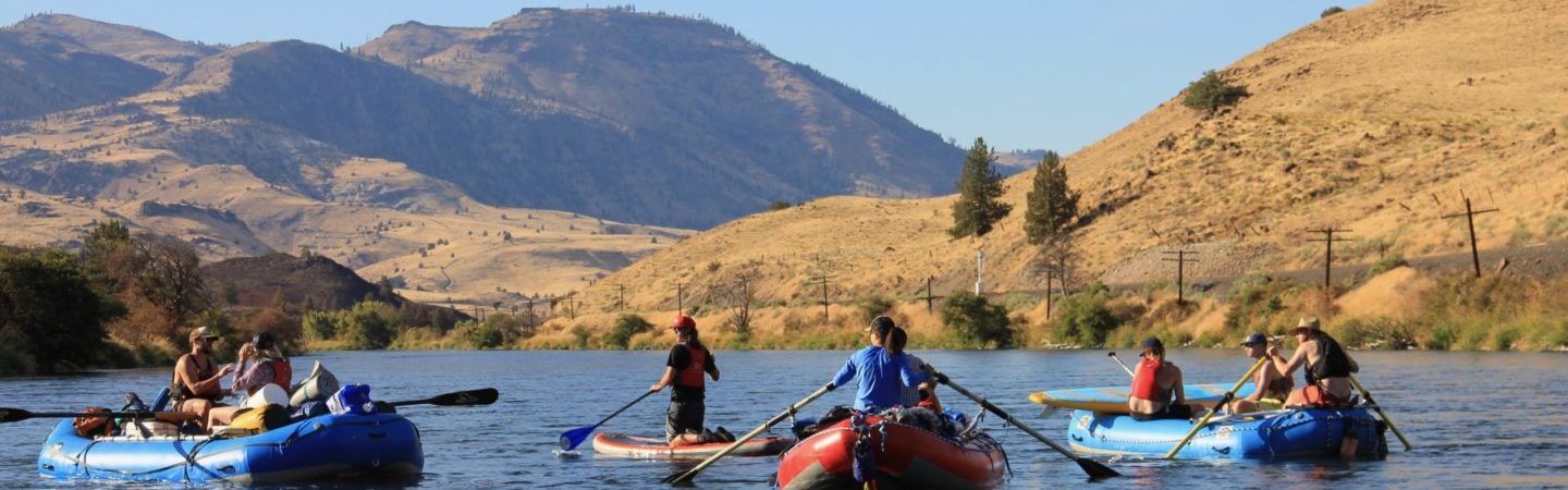
In addition to rafting, kayaking and boating, the entire stretch is riddled with railroad history, opportunities to forage, wild horses, bird and butterfly watching and excellent, some say world-class, angling.
For 29 miles the river's left bank borders the Confederated Tribes of Warm Springs Reservation which is the land of Warm Springs, Wasco and Paiute Native American Tribes. Please respect Warm Springs as a sovereign nation by not exiting your vessel on this side of the river.
Trip Highlights
Mile 0: Put-in at Warm Springs Boat Ramp State Park
Mile 7: Frog Springs Campsite. This is a favorite stop for lunch under the riverside canopy of a large willow tree. Walk a little further and find a serine bridge over an icy cold creek drainage.
Mile 10: Trout Creek. Last river access for 39 miles.
Mile 14: Warm Springs River confluence. Ospreys are common at this confluence and the entirety of this river corridor. Once you spot the bird of prey, look carefully at their talons to see if they are carrying a fish. If not, watch to see if they dive for one.
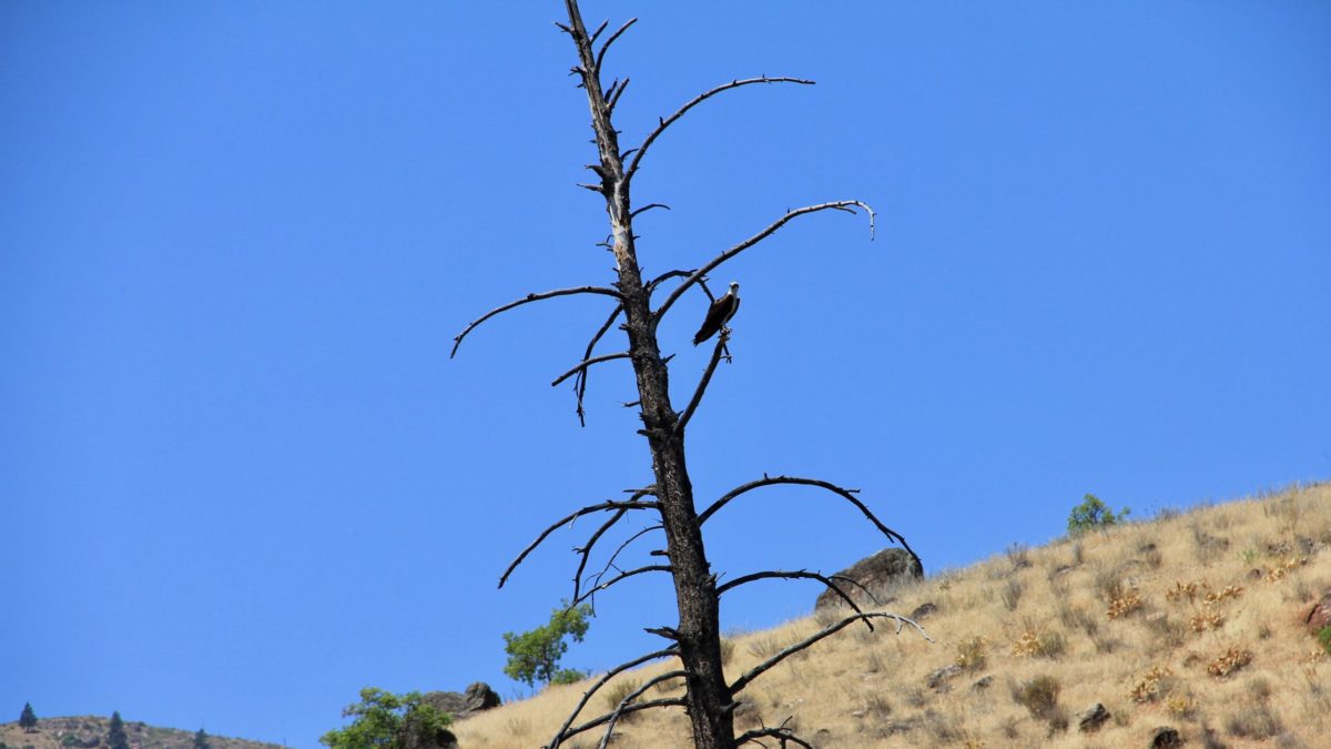
Osprey keeping a close eye on everything
Mile 21: River right outcrop. Example of extreme pressure exerted during volcanic formation and the type of unstable bedrock which made railroad planning difficult and hazardous to engineers. Observe signals like warning lights and spring-loaded wire fencing along the rail line which have been enlisted to alert oncoming trains of rock fall dangers.
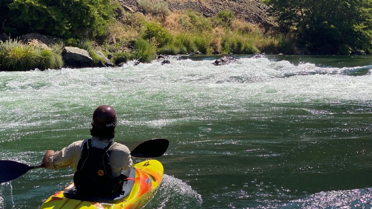
Mile 21.5: Whitehorse Rapid Scout Point. Scouting is recommended! Scout eddy located on blind river-right corner, just after a straightforward Class I+ V-wave. Climb a short embankment to the railroad. Follow railroad downriver a quarter mile to scouting point. Watch for poison oak. Active railroad - DANGER. Stay off track.
Whitehorse Rapid (III+). Large rocks, standing waves and turbulent currents make this half mile long rapid the most difficult rapid in the section. Although the crux is at the entrance and seen from the scout point, boaters should expect to stay alert during two more miles of busy water.
Mile 29: Warm Springs Reservation boundary, end of reservation.
Mile 33: Dant Ferry. This ferry and former war surplus lifeboat delivers patrons of the hole-in-the-wall fishing hamlet of Dant, a former mining town, from river-right, where the road lies, to river-left where the town resides.
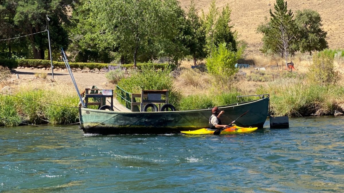
Dant Ferry
Mile 35: Buckskin Mary (III). Roller coaster wave train.
In the river-right eddy of Buckskin Mary
Mile 42: Harphem Flat take out. River-right notice large swaths of ramped areas for take out. Often present are rangers and many commercial vehicles putting in 4-stack rafts for the Maupin day stretch of the Deschutes River are present. Be friendly and share the occasionally crowded space.

