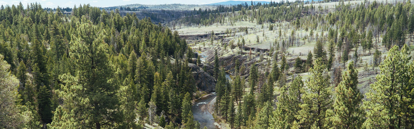
The North Fork Crooked is a National Wild and Scenic River that flows through public land managed by the Ochoco National Forest and Prineville BLM. The part managed by the BLM is also a wilderness study area. This is a great two day trip with high desert scenery through ponderosa pine forest and basalt canyons.
There currently is no gauge for this run. The tricky part of doing this run is to figure out when the road to Deep Creek Campground is open and there is enough water in the river. This typically occurs a few weeks after the road to Deep Creek Campground is clear of snow.
Trip Highlights
Mile 0: Put in at the Deep Creek Campground near the confluence with Deep Creek.
Mile 8: Upper Falls (V) is typically portaged on the right. You'll see a barbwire fence on the right bank just before a basalt lead in rapid above the falls. Take out on the right at the barbwire fence to scout or portage.
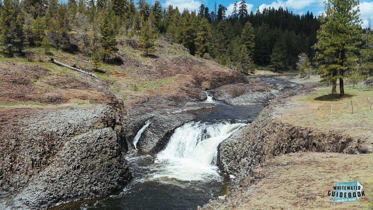
Upper Falls on the North Fork of the Crooked River at Low Water
Below Upper Falls is a series of bedrock drops that can be scouted while portaging.
Mile 16.5: Portage around Lower Falls on river left.
Mile 26: Take-out at the confluence with the Crooked River. There is no good parking here but there are some places to leave your car along the road. Please be careful to respect private property.

