In 2024, the dam at the headwaters of the Klamath River was removed.
Please note, the write-up below has not been updated since before the dam was removed and may contain some inaccuracies.
The Upper Klamath is a class IV+ run that begins in Southern Oregon and ends in California. This is a consistent big water run even in mid summer due to dependable dam releases from John C. Boyle Powerhouse. Above 4000 the river starts to develop a strong push and starts edging into class V territory.
The river cuts a steep wilderness canyon through a high desert volcanic plateau at the south edge of the Cascades. The area is rich in Old West history with old cabins, mines, and long-deserted Indian settlements. It's also a major stop on the Pacific flyway, with frequent sightings of bald eagles, osprey, and blue herons.
Featured Outfitter
 Momentum River Expeditions (541) 488-2525 offers world-class rafting and adventure travel trips in Oregon, Northern California, Idaho, Alaska, and beyond.
This river makes a very action packed 1-day trip or a base camp style 2-day trip (There is a 'safari style' riverside camp with luxury camping and multi-sport options). Because there is a warm up stretch the Upper Klamath is a great rafting trip for both experienced and first-time paddlers in good health.
The river starts off with several miles of Class II and III warm up rapids before passing the historic Frain Ranch area (a great campsite). After Frain ranch the canyon constricts and drops into the famous five mile 'Hells Canyon' gorge. The first big rapid is Class IV+ Caldera rapid; a long steep drop with many rocks and holes. Below here are several Class III rapids followed by the Class IV Satan's Gate. Immediately after Satan’s Gate is Hell's Corner - an amazing half-mile long Class IV+ rapid that for many is the highlight of the run.
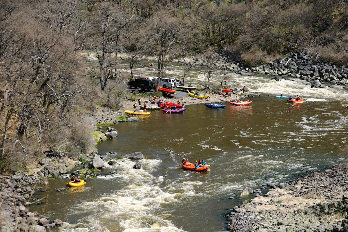
After Hell's Corner are more Class III and IV rapids including Ambush, Old Bushwhacker, Snag Island Falls, and finally State Line Falls. There are several takeouts after state line, where the river changes to mellow class II untill it dumps into copco lake.
The shuttle is over 100 miles and a designated shuttle driver is recommended. For those with 4w drive, high clearance, and high confidence, the topsy grade road on river left allows a put in right above the action at caldera.
Trip Highlights
Mile 0: Put-in at the Spring Island River Acess a few hundred yards downstream from the John Boyle Powerhouse.
Put-in for the Upper Klamath River
Mile .05: Saddle Horn Rapid (III)
Mile .9: Osprey Rapid (III). Ospreys are often seen along this stretch of the river
Mile 2.8: Klamath River campground (BLM) on river right.
Mile 4.9: Frain Ranch. Historic site and alternate put in, accessible by topsy Grade road on river left.
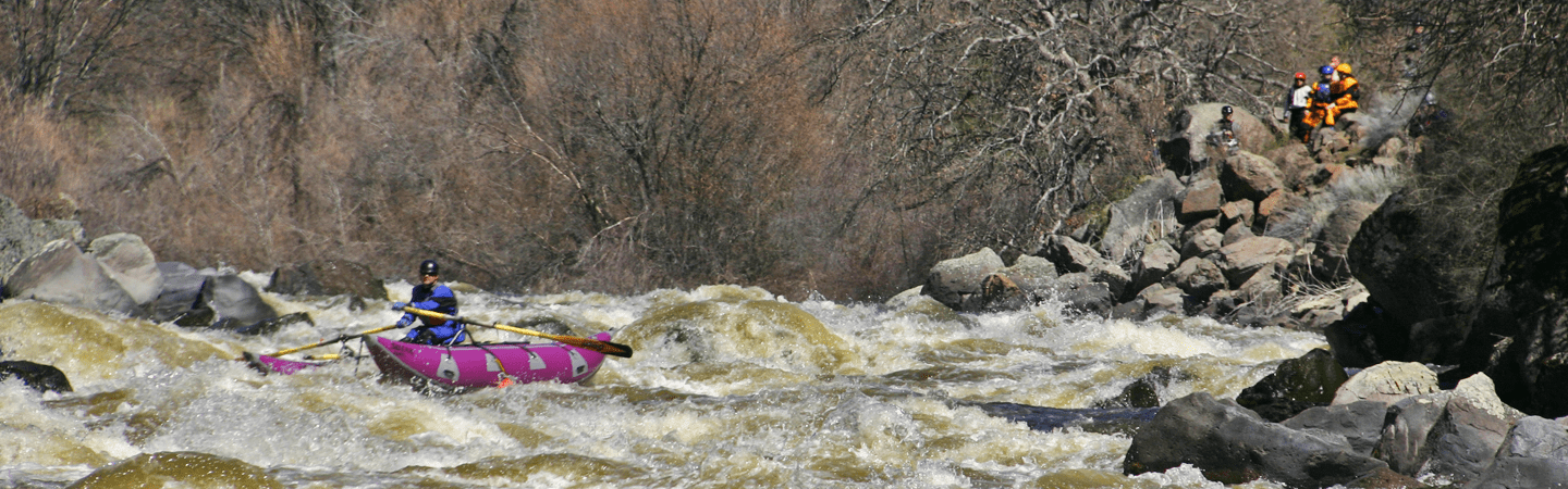
Mile 5.7: Caldera Rapid (IV+) and the beginning of the Hells Canyon Section. The gradient here steepens to 75 fpm. Scout from the Left
Caldera Rapid on the Upper Klamath River | Photo courtesy of Momentum River Expeditions
Mile 6.0: Bermuda Triangle (III)
Mile 6.1: Gunsmoke (III)
Mile 6.6: Branding Iron (III+)
Mile 6.9: Satan's Gate (IV) Easily avoidable sieve ¾ of the way through the rapid on the left side, only 100 yards of water separate the exit of this rapid with Hells corner.
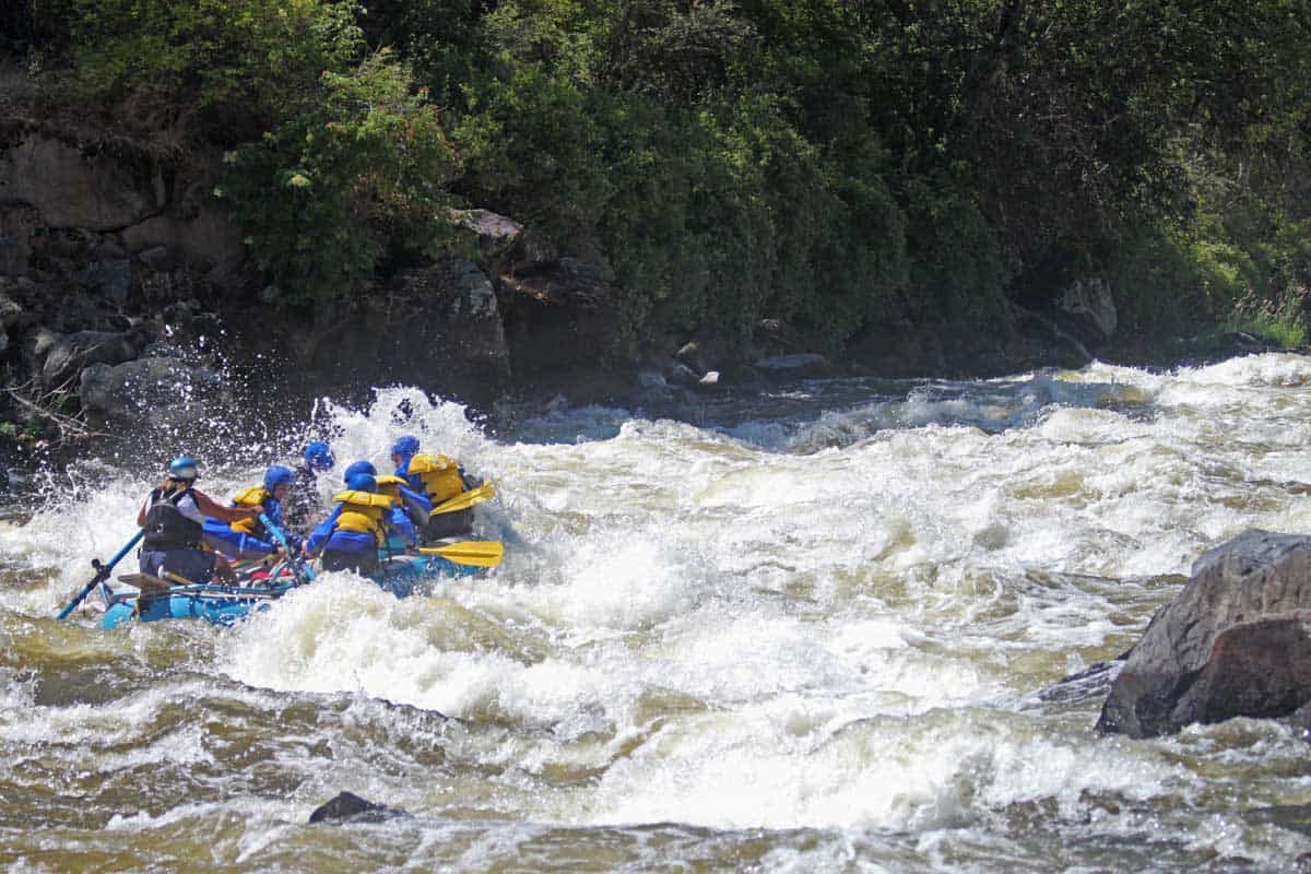
Mile 7.07: Hell's Corner (IV+)The continuous moves, blind entry, and difficult scout combine to make this the most difficult rapid on the run. Shallow with many sharp rocks.
Mile 7.4: Dragon (IV)
Mile 7.5: Jackass (III)
Mile 7.71: Scarface (IV)
Mile 7.9: Dancehall (II)
Mile 8.09: Ambush (IV)
Mile 8.13: Ol’ Bushwhacker (III)
Mile 9.9: Snag Island (IV) most people run the right channel. The left side is a class IV+/V rapid that at regular flows (~1700 cfs) has very little water.
Mile 10.4: Wells Fargo (III)
Mile 11: Stateline Falls (III). Just downstream of the falls is a free campsite on river left accessible by ager beswick road. If shuttling via topsy grade(it becomes ager beswick) this is a good take out.
Mile 11.68: Access #6. A popular rafting take-out. All major rapids are upstream of this point but you can continue 5 miles downstream to access 1, the final take out before Copco lake.

