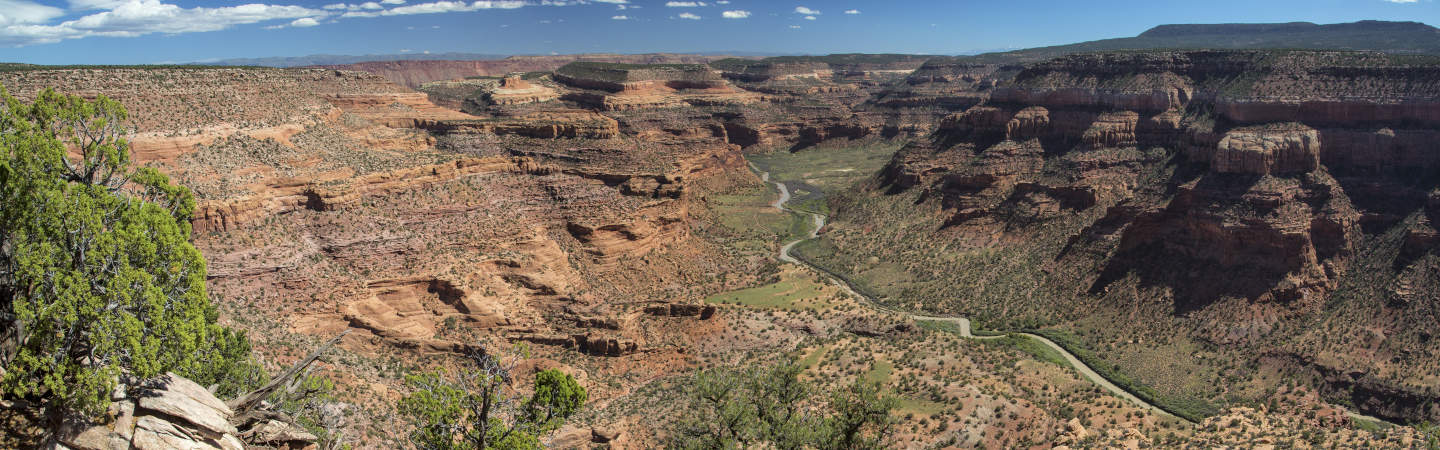
The Dolores River is an infrequently run gem. The upper sections in Colorado provide some fantastic class IV paddling, and the lower section from Gateway to Dewey Bridge is a fantastic desert multi-day. Most of the rapids are class II, however there are a few class III's which can start creeping into the class IV range at high water. This section brings you out of the high, Colorado desert and down into the red rock of southern Utah. The dramatic landscape changes along with the feeling of complete isolation make this river trip a must-do.
Unfortunately, the flow in the Dolores is at the mercy of the McPhee dam. This keeps the flow in the lower section of river at un-runnable levels most of the year. Depending on the snowpack and weather conditions, the river may not run at all. If you want to run the Dolores, you need to keep an eye and ear on the McPhee release schedule and wait until they release a reasonable amount of water. This typically occurs on years with a large snowpack between April and July. These releases could be a day, week, or month long, so you have to be flexible and get it while the getting's good.
This river makes for a great duckypacking trip since it is often run at very low water levels. Small 10 and 12 foot rafts are also a good option, with full sized rafts feeling a little too large. It is best done as a three day trip at lower water, but can be done as an overnight when the water is high.
Trip Highlights
Mile 0: Put in the the town of Gateway. As this river isn't run very frequently, there isn't a great boat ramp. On the west side of the river there's an access area.
Mile 4.1: An old, destroyed low-head dam makes for a complicated hazard. Small crafts can portage on river left, full sized rafts should scout and pick the best line based on water level.
Mile 8.3: Stateline Rapids (Class III/IV-). This long set of rapids is Class III at lower water levels, and at levels over 2,500 starts to creep into the class IV range because there is little space between rapids. It's recommended to scout the first section. After the first rapid, a hard right turn around an island is required to avoid the shallow left side. The rapids get easier as you go along, finishing at the end of the island.
Mile 11.9: Rock Slide Rapid (Class III). The river is blocked by a collection of large boulders. At flows over 2,000 cfs, the water starts to push hard into the boulders, presenting a challenge to beginners and larger crafts. Above the rapid on the left is a large, shady campsite that works great for night one.
Mile 21.5: Line Canyon comes in from the left. This wide, open canyon offers some nice side hiking.
Mile 31.4: The Dolores River confluences with the Colorado River.
Mile 33.4: Dewey Bridge boat ramp and the takeout! This ramp is also the put-in for the Moab Daily section, so if you want to extend your trip that's a great option.

