The Escalante is a full on packrafting or pack-duckying expedition. Running through the Escalante District of the Glen Canyon National Recreation Area, this river is as isolated as they come. The river cuts a course through fabulous, deep red rock canyons winding through the Utah desert. Many opportunities for exploring side canyons exist, but there's a chance you'll be too exhausted after a day on the river. This is not just a simple float trip; it's a challenging yet rewarding way to experience one of Utah's treasures in a completely unique way.
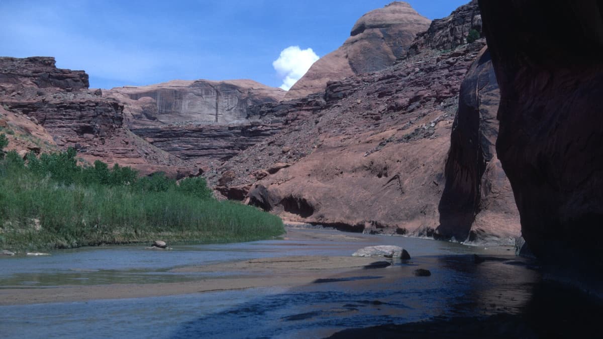
The Escalante flows through picturesque Utah desert landscapes. Photo courtesy of the S.J. and Jessie Quinney Library.
The season for the Escalante is fickle, being heavily dependent on snowpack and weather. Pay attention to the guage and be flexible with when you can go. The minimum recommended level is 50 cfs, any lower and you'll find yourself dragging your boat more often than floating. Be ready for changing flow conditions and wary of flash flooding. The rapids on the Escalante are no harder than Class II+, however can be altered dramatically by debris pileups. Good scouting and decision making is a must, and expect to spend some time portaging around debris fields created by flash flooding. Plan for at least 6 days, but be prepared to be flexible.
Trip Highlights
Mile 0: Your journey starts at the Escalante River Trailhead off of Highway 12. The first six miles are flat and easygoing.
Mile 6.3: Boulder Creek joins the Escalante from river left.
Mile 6.3-15.4: For several miles after Boulder Creek, boulder gardens create Class II+ rapids. These look dramatically different depending on water level and recent debris flow.
Mile 18.5: Horse Canyon comes in from the left, offering a nice side hike if you have the energy for it.
Mile 28.1: Silver Falls Creek joins the Escalante from the left, adding to the flow and offering a nice side hike.
Mile 35.6: Neon Canyon comes in from the left. Half a mile from the river is the Golden Cathedral, a spectacular red rock alcove. This site will convert you to the church of the desert, and is a must-see. With advanced canyoneering skills, you can descend Neon from the top and rappel into the Golden Cathedral.
Mile 36.7: Ringtail canyon is a short but sweet slot canyon requiring advanced canyoneering skills to explore.
Mile 52.3: After Scorpion Gulch joins the river, the river enters the softer, more easily eroded Chinle formation. The next 20 miles are the most difficult stretch of river, with boulder fields, steep slots, and undercut banks.
Mile 61.7: An un-named jumble of boulders completely blocks the river. This is the only mandatory portage on the river.
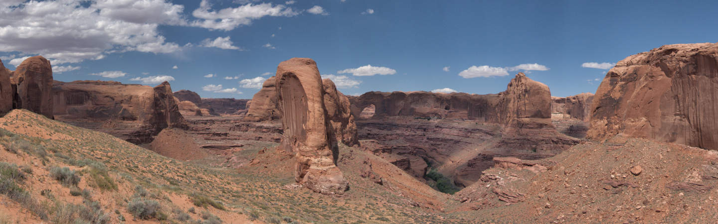
Mile 71.3: Stevens Arch is dead ahead. This sight marks the end of the difficult section of the river.
Mile 72.3: Coyote Gulch joins the river from the right. This canyon provides an alternate exit for those that don't mind a six mile hike. Coyote Gulch is a desert oasis. If you decide not to end your trip here, you should at least spend time hiking up Coyote Gulch. Another alternate exit at Coyote Gulch via the Crack-In-The-Rock trail exists, which is a shorter but significantly less beautiful hike.
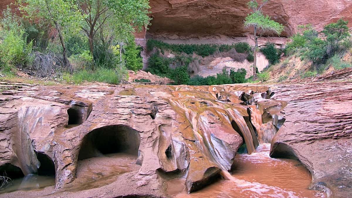
Pristine water features are a highlight of Coyote Gulch. Photo by John Fowler.
Mile 82: Depending on the level of Lake Powell, you will encounter the lake somewhere around Mile 82. If the lake has receded recently, be prepared to drag your boat through a lot of mud.
Mile 96: Stay with the largest, main channel of the lake and paddle 4 miles of lake to the takeout at the end of Hole in the Rock Road.

