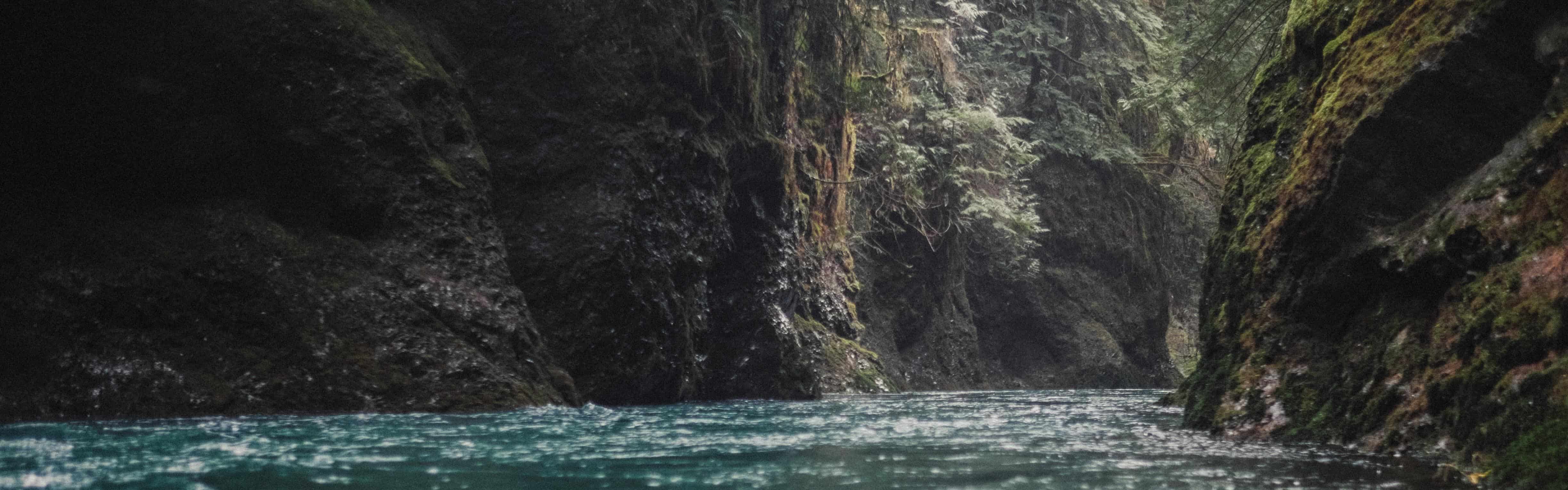
Located in the southwestern corner of the Olympic Peninsula, the East Fork of the Humptulips River flows through an area of mostly commercial forestlands. On the way to the put-in, paddlers may wonder about the scenic reputation the Narrows have cultivated as they drive through some of the most heavily logged areas of the peninsula. Those thoughts though, quickly disappear as the East Fork plunges into a gorge that replaces clear-cuts with basalt walls and numerous waterfalls.
From the put-in, the river meanders for a short while before sheer walls create this section’s namesake Narrows. Just as the gorge closes in, the water plunges over an unrunnable boulder ledge, and paddlers will want to get out on river left above this feature. Once through here, the gorge and its mostly Class III whitewater continues all the way to take out. At times the river constricts to only about ten feet wide, so boaters will want to be vigilant about checking for wood hazards before committing themselves to any blind corners or horizon lines.
Trip Highlights
Mile 0: Put in. At mile 3.6 on FR 2206 look for the faint remnants of an old logging road, now blocked by a berm and keep to the right while making your way down to the river.
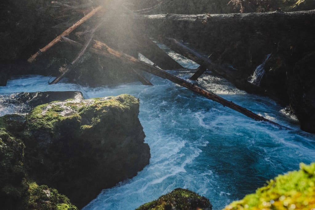
A log jam below the fish ladder. Photo by Nate Wilson Photography
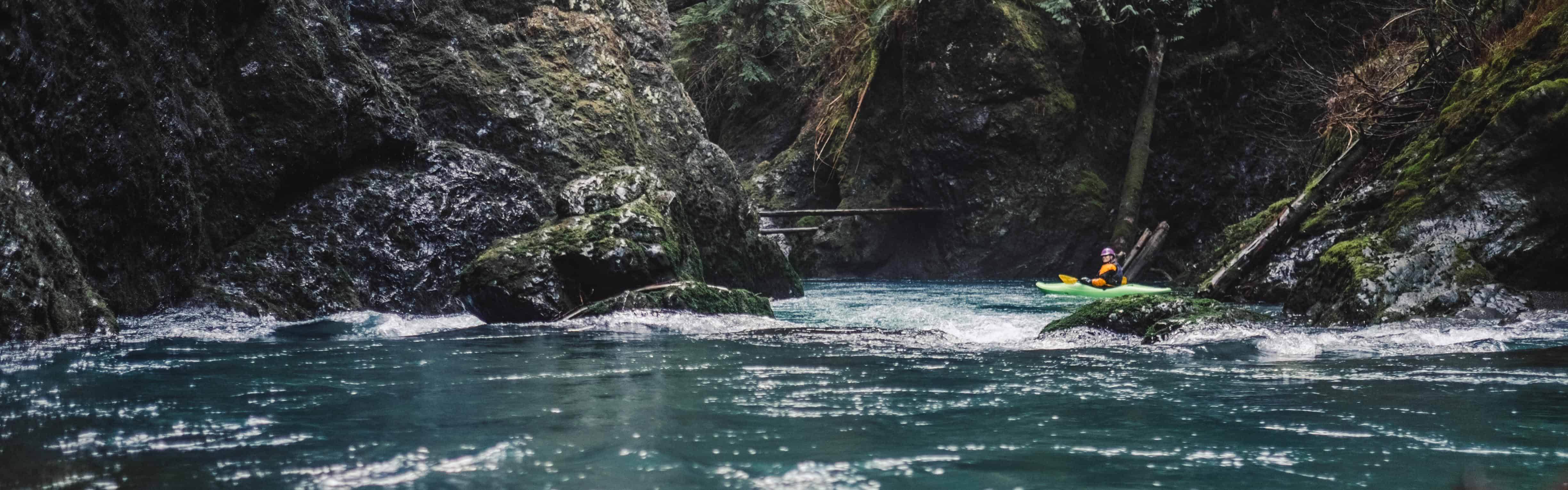
Mile 1.9: Fish Ladder and beginning of the Narrows. The boulder drop is unrunnable and the fish ladder should be scouted for wood. Boaters can make their way down the fish ladder on river left or seal launch below if it is clean of wood. Alternatively, portage on river left and put in at a small alcove downstream. Higher than recommended flows can make this drop difficult to portage.
Goforth Creek entering the Humptulips Narrows. Photo by Nate Wilson Photography
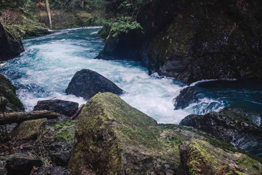
Mile 3.7: Goforth Creek enters on river right.
The newly formed landslide rapid in the East Fork Humptulips Narrows. Photo by Nate Wilson Photography
Mile 3.8: Landslide (Class IV). Scout and portage this newly formed rapid on river left or run it on the far right. Higher than recommended flows can make it hard to scout or portage this drop.
Mile 4.6: Takeout (FR 22 Bridge). Boaters can take out slightly upstream of the bridge on river left, or continue downstream to a spot where the road is closer to the river.

